Long known as a premier provider of land surveying services in Southern California, WLG also has significant expertise in providing cutting-edge geospatial solutions. We offer a full range of ground and air-based technology to address client needs including LiDAR scanners, 3D imaging equipment and a fleet of Unmanned Aerial Vehicles (UAVs). We are proud to have been recognized as one of America’s Top 100 Gespatial Firms.
WLG’s core competency of surveying and mapping is the basis for the broad menu of services we offer today. The complete, accurate information we provide through traditional ground-based techniques and cutting-edge geolocation and aerial technology lays the foundation for solid design, efficient construction and successful projects.
Construction Support
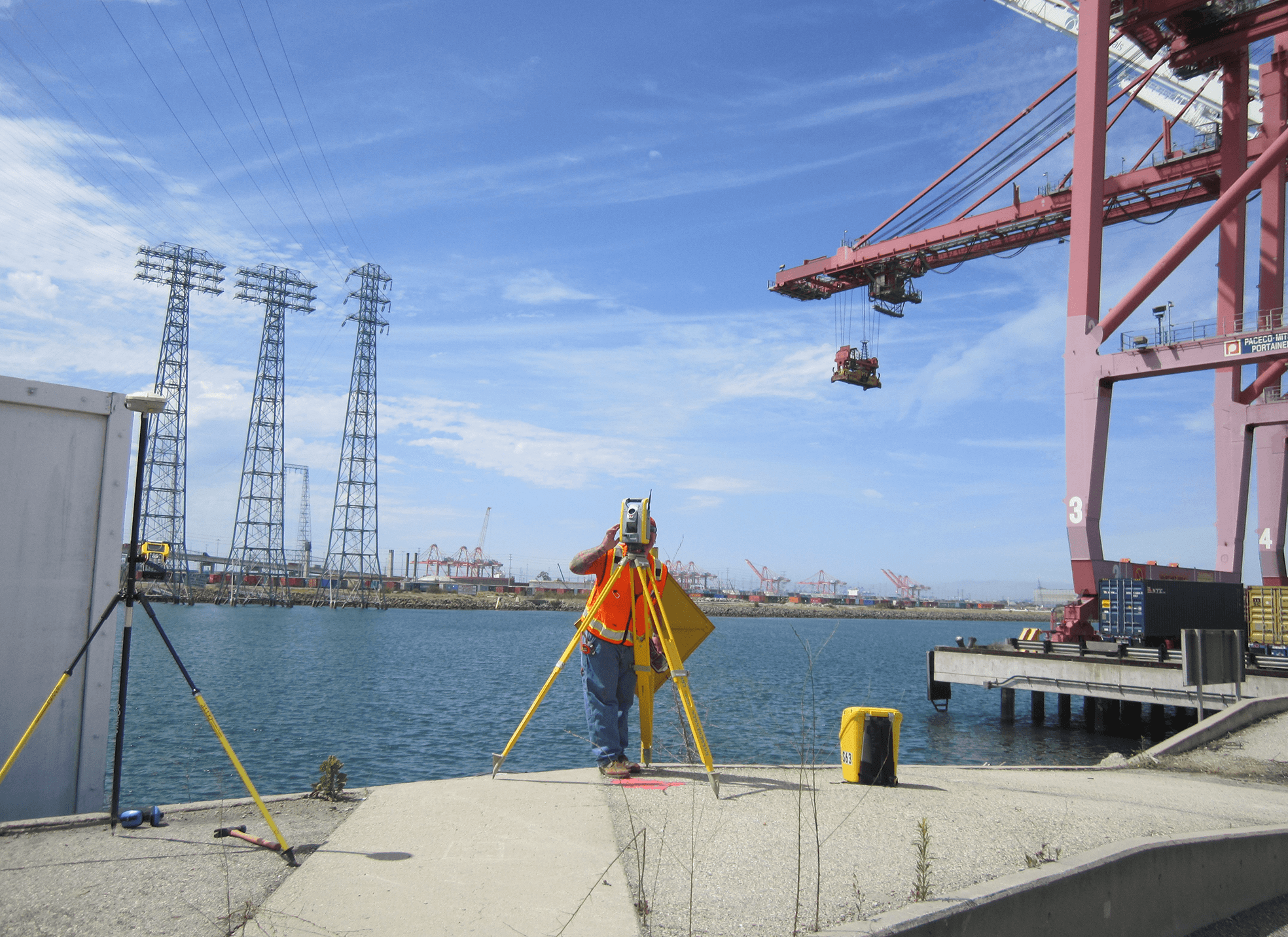
Cerritos Channel Survey | Southern California Edison (SCE), Port of Long Beach (POLB) | Terminal Island, CA
Larger container vessels and increased ship traffic at POLB have required extensive modifications to POLB’s main waterway and electrical infrastructure. Working closely with SCE and POLB Operations, WLG precisely mapped the Cerritos Channel and SCE’s electrical facilities, and provided construction support to insure the smooth flow of cargo through this crucial part of the U.S. supply chain.
Design Survey
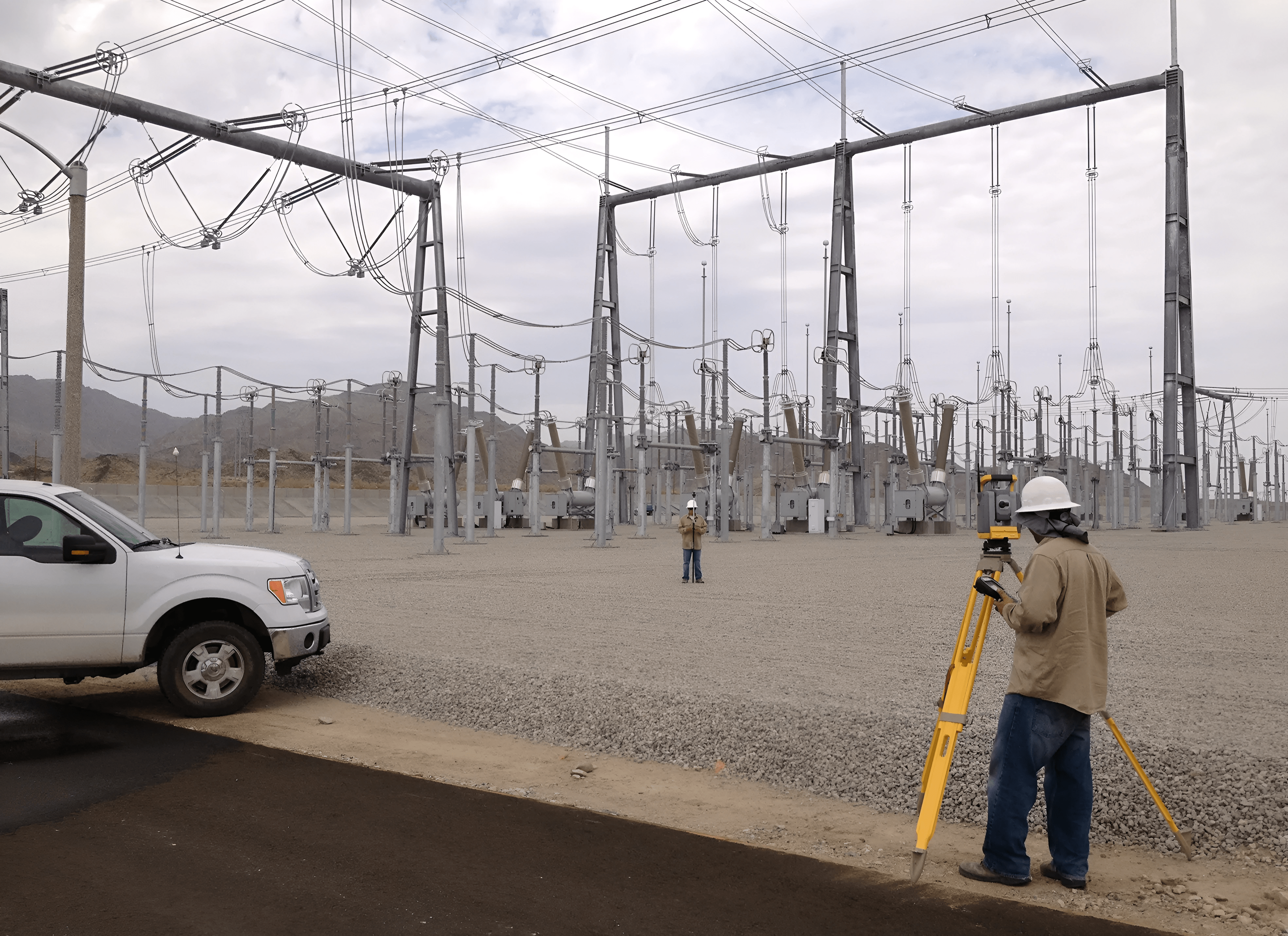
Red Bluff Substation | SCE | Red Bluff, CA
WLG has played an instrumental role in the reinforcement of the region’s electric grid. Working in collaboration with SCE, our survey teams documented boundaries and rights of way for new substations and transmission lines to improve the grid’s resilience, stability and readiness for California’s electrified future.
Mapping
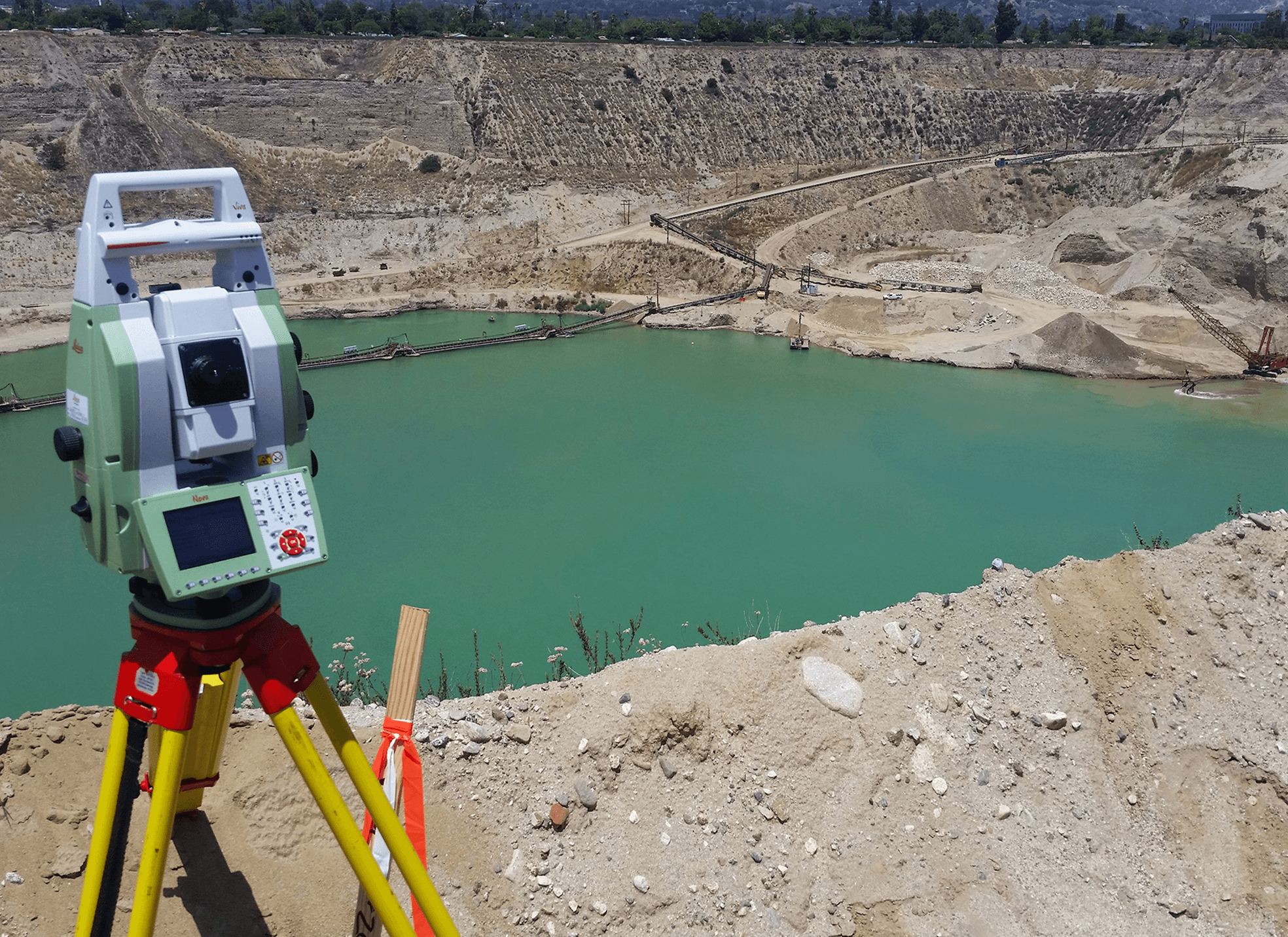
Irwindale Pit Mapping | City of Irwindale | Irwindale, CA
WLG conducts open pit mining surveys to map the City of Irwindale’s extensive rock quarries. Using photogrammetric and bathymetric surveys, conventional and GPS/GNSS techniques, WLG produces accurate lake bottom profiles and color-coded maps used to estimate underwater material extraction, confirm slope stability, and compare material removal volumes year over year. Topographic and boundary survey maps at 11 locations within the city will be used to facilitate pit reclamation for recreational and other uses in the future.
See Fewer Projects
See More Projects
LiDAR and 3D Laser Scanning
WLG’s laser scanning and 360-degree video capabilities guarantee accurate data capture of construction routes and facilities. These datasets, gathered with our arsenal of ground or aerial-based technology, can be used for compliance verification or future retrofit and upgrade studies. Such cutting-edge equipment offers a significant cost saving over deploying crews to physically capture the data.
Photogrammetry
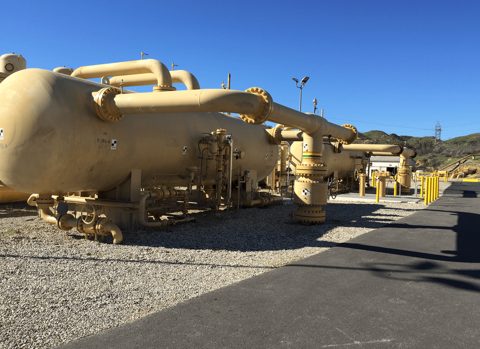
Pipeline Survey | SoCalGas | Los Angeles County, CA
California’s dynamic geography requires gas utilities to maintain precise location information for all wells, pipelines, and fittings. SoCalGas relied on WLG’s photogrammetry and GIS expertise to develop 3D Digital Terrain Maps pinpointing equipment locations. The sophisticated maps are used to study the feasibility of automated hydraulic modeling for new pipeline design, improving safety and gas delivery.
Laser Scanning
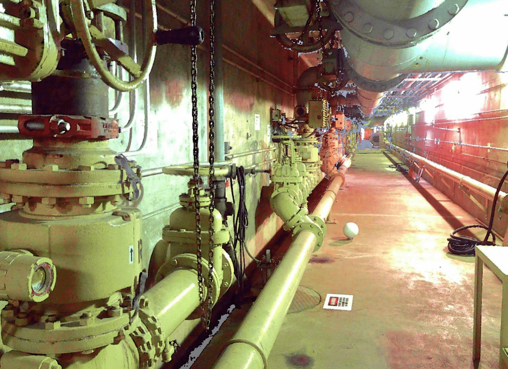
Los Coyotes Water Reclamation Plant | Los Angeles County Sanitation District (LACSD) | Cerritos, CA
LACSD hired WLG to precisely map underground galleries at its Los Coyotes Water Reclamation Plant, so engineers could design electrical conduit routes and conduct conflict analysis. WLG crews provided high-resolution laser scans of approximately 550 feet of tunnels and galleries–all in one day rather than the five to six days a traditional survey would have required. The full survey control report and 3D point cloud of the large data set are easily accessible for convenient, in-office measurements.
See Fewer Projects
See More Projects
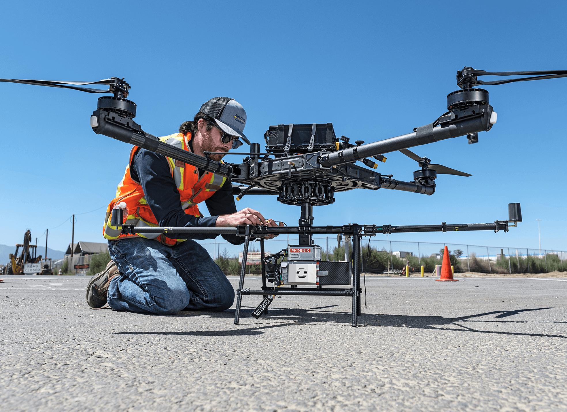
Unmanned Aerial Systems (UAS)
WLG is a pioneer in the use of UAS and UAVs to improve the accuracy, cost-effectiveness and safety of data gathering at large or remote project sites. UAVs provide high-resolution images using GPS coordinates, and can be used to create 3D point clouds and Digital Terrain Models (DTMs). All WLG pilots have the necessary FAA licenses to operate UAVs for geospatial services.
Facility Inspections
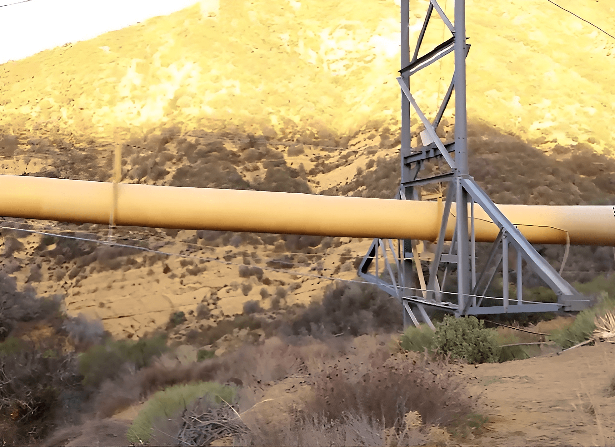
Liebre Span Inspection | SoCalGas | Gorman, CA
WLG’s UAV team has conducted many compliance inspections for major utility companies. Pilots routinely operate these aircraft safely at remote facilities like this high-pressure gas pipeline in earthquake-prone Gorman. UAV inspections are inherently less dangerous to conduct than physical inspections and gather significantly more data than methods relied on in the past.
UAS Aerial Scanning
CUSHENBERRY Facility | Mitsubishi cement corporation | Lucerne Valley, CA
The Mitsubishi Cement Corporation needed to document existing facilities at its Southern California Cushenberry cement plant facility to facilitate new construction. WLG’s UAV team laser-scanned four acres of the facility, including a tower whose 30-foot diameter pipe is used to preheat materials for combustion. WLG provided a point cloud of 30+ scans and 3D modeling of the tower’s structural beams so engineers could design a new catwalk near the tower’s access hatch for kiln sampling and environmental compliance.