Utility Locating
WLG provides above and below ground locating and detection services for wet and dry utilities including research, field investigations, surveying/ mapping, engineering design, and construction support. The team provides utility locating and mark-out using proven industry techniques and
equipment including advanced Ground Penetrating Radar (GPR), conventional field surveys, mobile data collection, electromagnetic and acoustic locating, and CCTV inspection. Utility locating methods that are employed at WLG reduce the need for unnecessary digging and site disturbance. WLG’s utility locating solutions help clients achieve facility identification results that can reduce conflicts with other utilities while minimizing risk and avoids added costs associated for delays, repairs, or redesigns.
Related Capabilities
- Above and Below Ground Utility Locating/Detecting
- Advanced GPR Data Collection
- Acoustic Locating
- CCTV Inspection
- Concrete Scanning
- Conventional Research, Surveying, Markout
- LiDAR (Terrestrial/Mobile)
- Mapping/Modeling
- Potholing
- Reporting
- Subsurface Utility Engineering (SUE)
- Traffic Control/Plans
- UAV (Drones)
Projects
3D REMOTE SENSING
WLG uses a vehicle-mounted, high-speed, 3D GPR array, four-wheel push cart carrier, and 3D tomography software for efficient subsurface mapping. The vehicle mount collects data at speeds in excess of 80 miles an hour at 5 cm intervals, which eliminates the need for traffic control and safety vehicles. With WLG’s 3D array project data can be measured in minutes and data sets processed while still in the field.
Transportation/Traffic
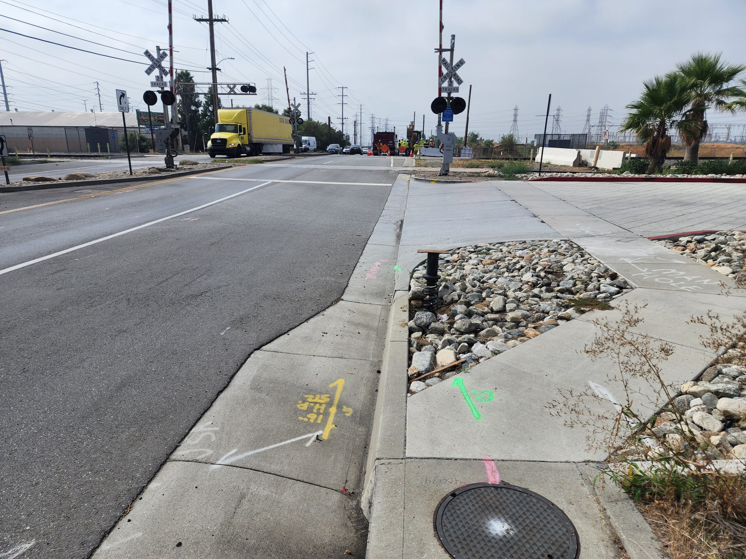
ETiwanda avenue grade separation | City of Rancho Cucamonga | rancho cucamonga, ca
WLG’s Utility Locating team conducted research and provided field utility investigation services using the firm’s mobile and pushcart GPR equipment along Etiwanda Avenue between Whittram and Napa Avenues for a new grade separation. The team provided CAD exhibits showing above and below ground utilities as part of the deliverables to the City.
Industrial
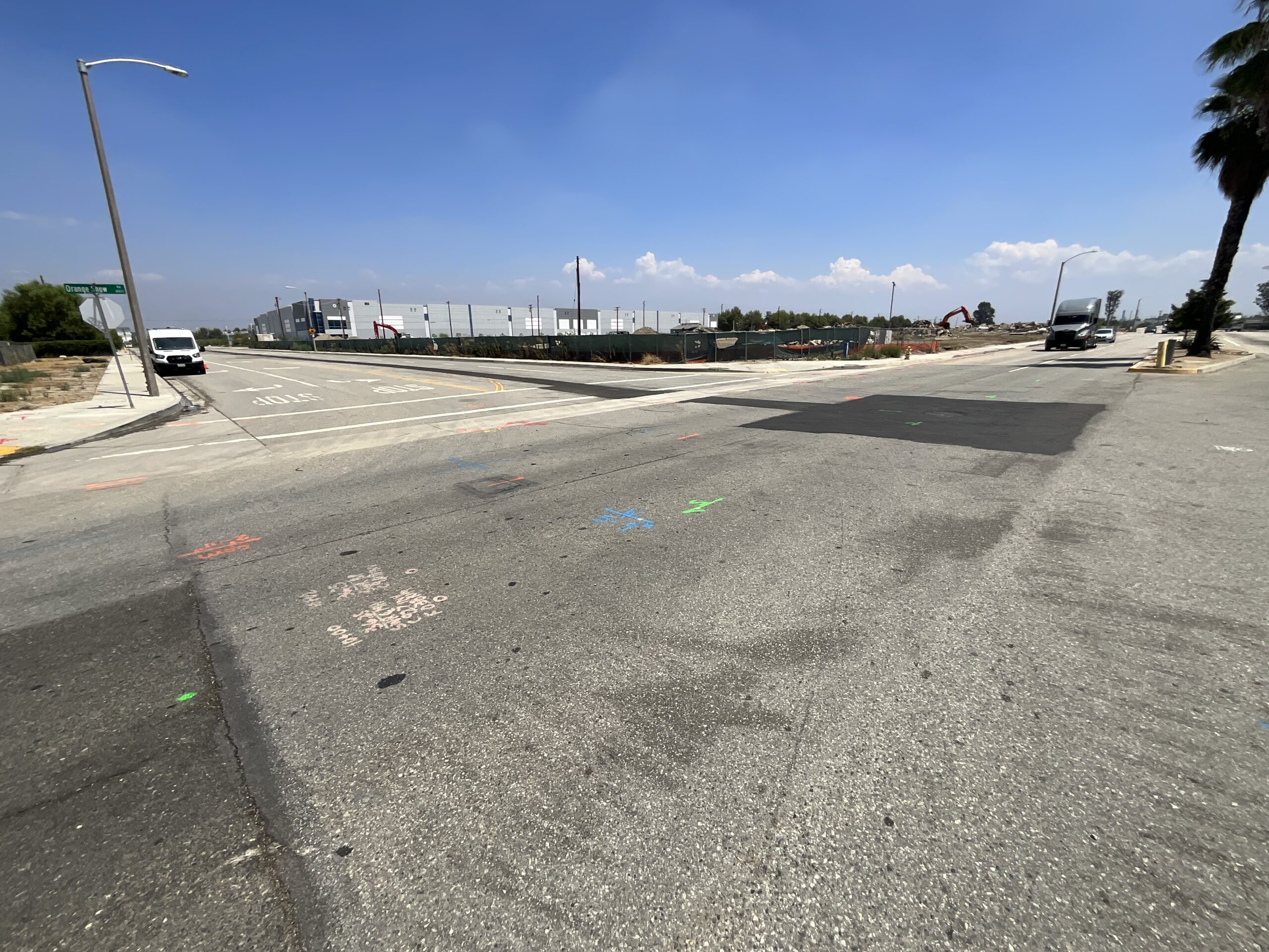
Gateway South Building 9 | Hillwood | San bernardino, ca
WLG provided utility investigation services including conventional survey,
mobile/puschart GPR, CCTV, and mapping for a new industrial project located at
Orange Show and Lena Roads in San Bernardino, CA. The team provided
research/planning, SUE field surveys including 3D remote sensing with
Raptor technology and electromagnetic GPR, GPS topo sweep of
above-ground utilities, survey of existing centerline monuments/ties,
UAV aerial survey, pushcams for location of the sewer and storm drains, and location/markup of existing utilities. WLG’s team also provided data analysis/ processing to provide boundary and base maps, topographic planimetrics, and a Underground Utility Report.
Advanced Ground Penetrating Radar (GPR)
WLG provides state-of-the-art techniques that include GPR and data collection platforms to expand capabilities, allowing identification of known, unknown, and abandoned facilities. GPR is a non-invasive technique used for investigating characteristics of subsurface employing high-frequency radio waves. GPS can survey through concrete, masonry, asphalt, and ground cover and provides high-resolution data within a short period of time. It has become a trusted technology for detecting and mapping underground utilities such as electrical, gas, sewer, water, and communication networks/lines.
Gas Pipeline
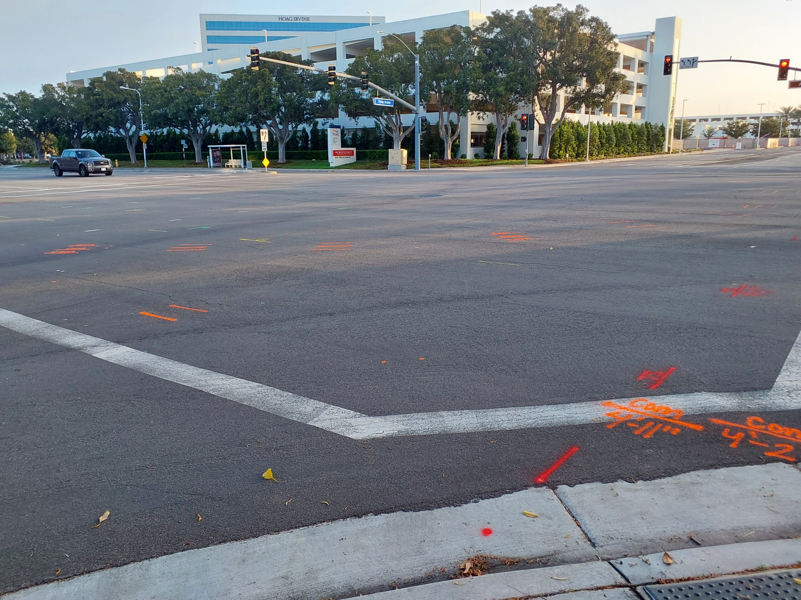
suE scan | Socalgas | ca
WLG’s Utility Locating team provided SUE and utility locating services for 920 linear feet of the design of a 6-inch gas line installation. Services included records research, subsurface utility scan of the project’s limits, a GPS topo sweep of the above-ground utility evidence, survey of existing centerline monuments and centerline ties to establish street right of ways, establishing control and tie-in to benchmarks, a terrestrial LiDAR scan to capture street improvements, and a boundary analysis for the street right of ways. The team prepared an AutoCAD topographic basemap depicting all of the locations of subsurface and above-ground utilities, existing street centerlines and right-of-way lines, curb and gutter and edge of pavement, and driveways.
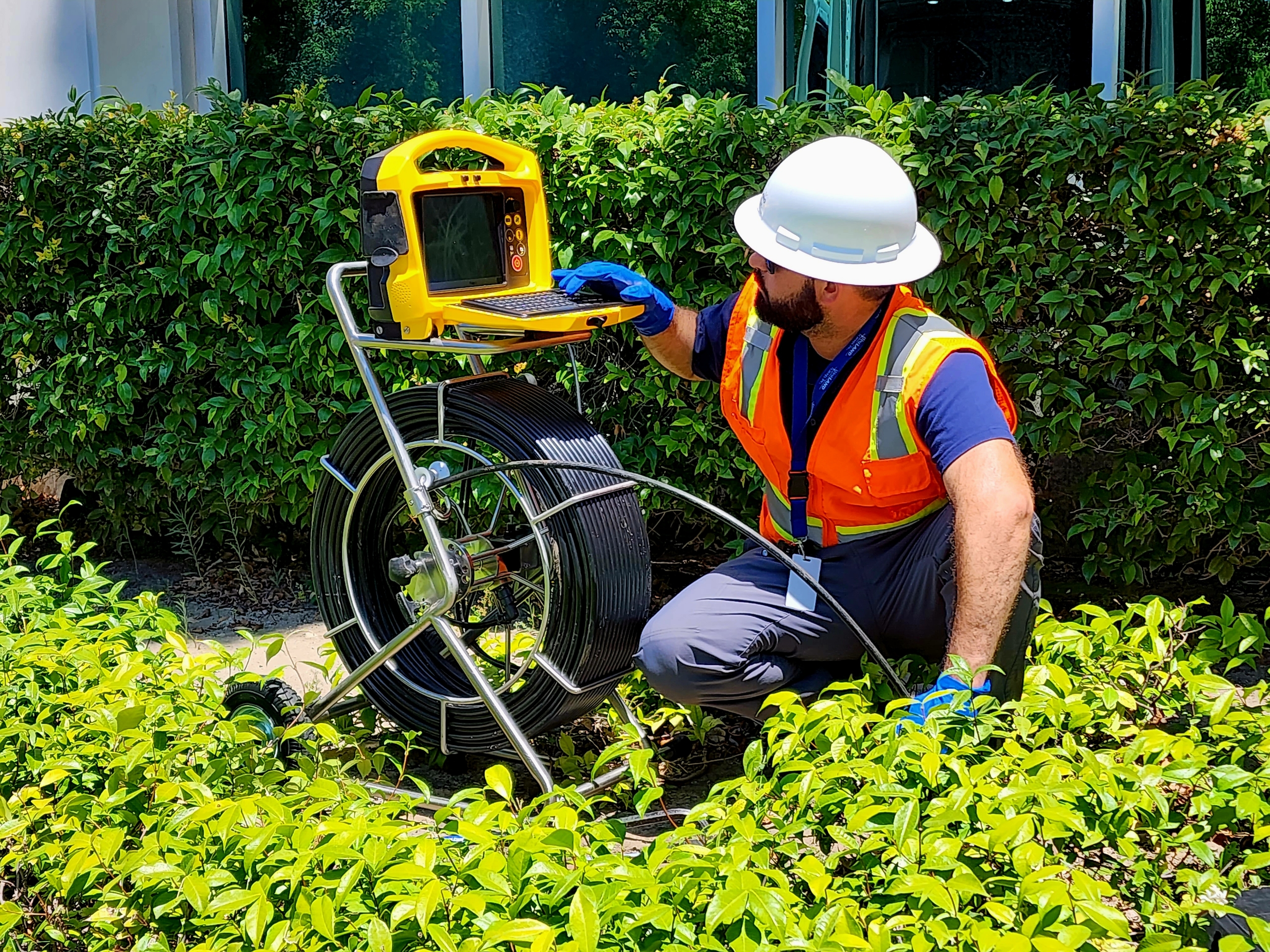
CCTV Inspection
WLG provides video inspection services (CCTV) to help locate and identify any damage to a municipal facility or utility infrastructure line such as leaks, roots, cracks, blockages, corrosion, or other defect. The team uses cutting-edge, non-evasive video camera equipment to inspect water, sewer, natural gas, lateral lines, and associated facilities.