
Geospatial
WLG is a premier provider of land surveying services, utilizing the latest industry technologies to capture vital data. This data is then analyzed and managed to create precise maps, models, and databases that support informed decision-making. By deploying a comprehensive range of ground and air-based technologies, including LiDAR scanners, 3D imaging equipment, and a fleet of Unmanned Aerial Vehicles (UAVs), WLG delivers cutting-edge geospatial solutions. WLG is proud to be recognized as one of America’s Top Geospatial Firms, a distinction that reflects our dedication to excellence in the field.
Did you know?
Geospatial engineering is the application of mapping and surveying technologies to collect, analyze, and manage spatial data. Geospatial engineers use this data to create detailed maps, models, and databases that assist with decision-making across a variety of sectors.
Related Capabilities
- As-Built, Boundary, and Topo Surveys
- Construction Staking
- Construction Monitoring/Support
- Exhibits/Plats/Legal Descriptions
- Geographic Information System (GIS)
- Land Base Mapping
- LiDAR (Airborne/Terrestrial/Mobile)
- Monument Preservation
- Records of Survey
- Right-of-Way Surveying/Engineering
- Unmanned Aerial Systems/Vehicles (UAS/UAV)
- Utility Research/Investigation/Locating
Projects
DESIGN SURVEY & MAPPING
WLG’s core competency of surveying and mapping is the basis for the broad menu of services we offer today. The complete, accurate information we provide through traditional ground-based techniques and cutting-edge geolocation and aerial technology lays the foundation for solid design, efficient construction and successful projects.
Design Survey
Public Works
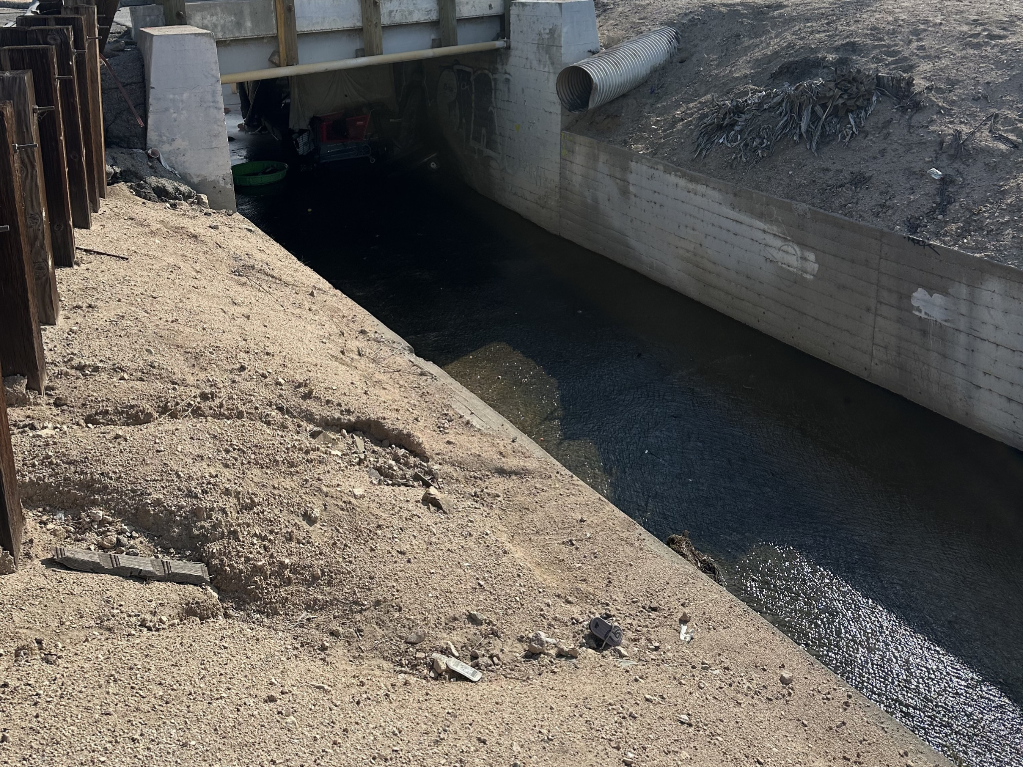
Del Rosa Channel | SAN bernardino county flood control District | San Bernardino, CA
WLG executed design survey and mapping services for the Del Rosa Channel Flood Control Improvement Project, supporting planned upgrades to approximately three miles of flood control infrastructure. Utilizing advanced survey control, topographic data collection, boundary verification, and utility mapping techniques, WLG developed accurate existing conditions mapping of roadway, drainage, bridge, utility, and right-of-way features throughout the project corridor. The resulting AutoCAD Civil 3D base mapping, digital terrain models, cross-sections, and drainage structure surveys provided critical data for hydraulic analysis, flood control design, and long-term infrastructure improvements.
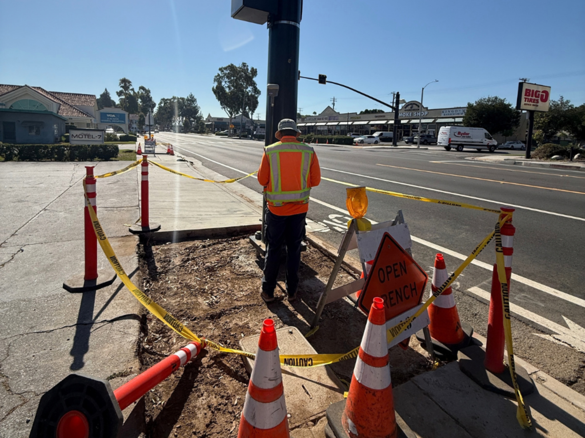
6th Street Survey | Corona, CA
WLG supported the City of Corona’s proposed 6th Street waterline improvements through comprehensive design survey and mapping services along approximately 6,800 linear feet of corridor. Services included topographic surveying, utility investigations, boundary control, right-of-way research, and subsurface utility verification. Utilizing a combination of conventional surveying, aerial mapping, LiDAR, Ground Penetrating Radar (GPR), and potholing techniques, WLG developed accurate existing conditions mapping of surface and underground infrastructure. The project supported utility coordination, design development, and the successful planning of future water system improvements.
Mapping
Utilities
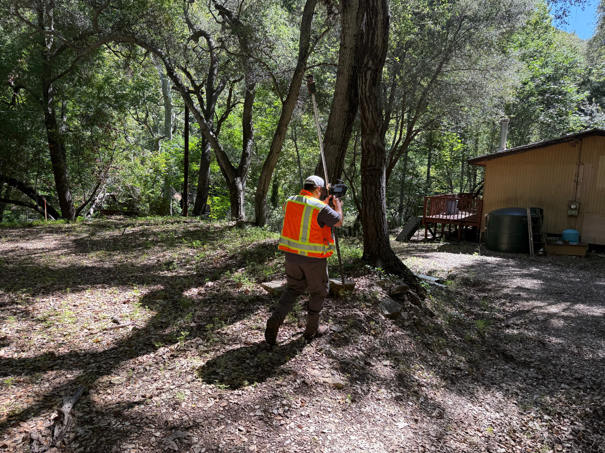
Community Wildfire Safety Program (CWSP) Distribution Capacity Mapping | PG&E | San Luis Obispo County, CA
WLG developed a comprehensive distribution capacity basemap for approximately six miles of PG&E utility infrastructure in San Luis Obispo County. Leveraging mobile scanning, fixed scanning, and conventional survey technologies, WLG captured detailed existing conditions data and produced high-accuracy topographic and planimetric mapping of roadway corridors, terrain, water crossings, and other critical infrastructure features. The project included the development of digital terrain models (DTMs), breaklines, and engineering-grade base maps, delivering accurate geospatial datasets to support utility planning, engineering analysis, system evaluations, and future infrastructure improvements.
Transmission
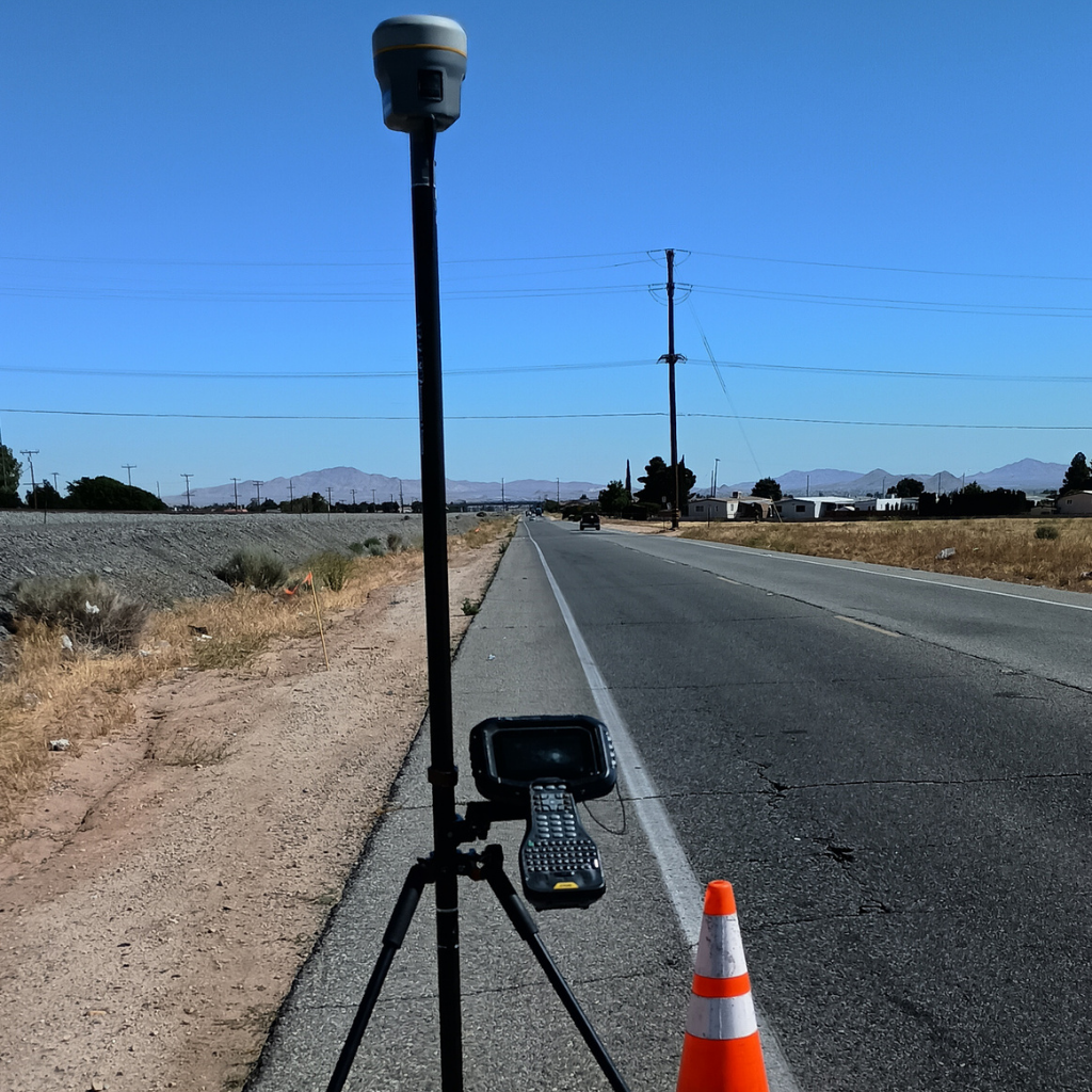
Off-Road Subtrans-Aqueduct Hesperia Survey |Southern California Edison | Hesperia, CA
WLG completed design survey and mapping services for approximately nine miles of Southern California Edison transmission corridor infrastructure. Services included aerial topographic surveying, LiDAR mapping, photogrammetry, survey control, and geospatial data processing. Utilizing UAV-based data collection and advanced positioning technologies, WLG developed accurate existing conditions mapping of transmission facilities, utilities, access roads, drainage systems, vegetation, and other corridor features. Deliverables supported engineering design, utility planning, corridor assessments, and future infrastructure improvements through survey-grade mapping and geospatial datasets.
Design Survey
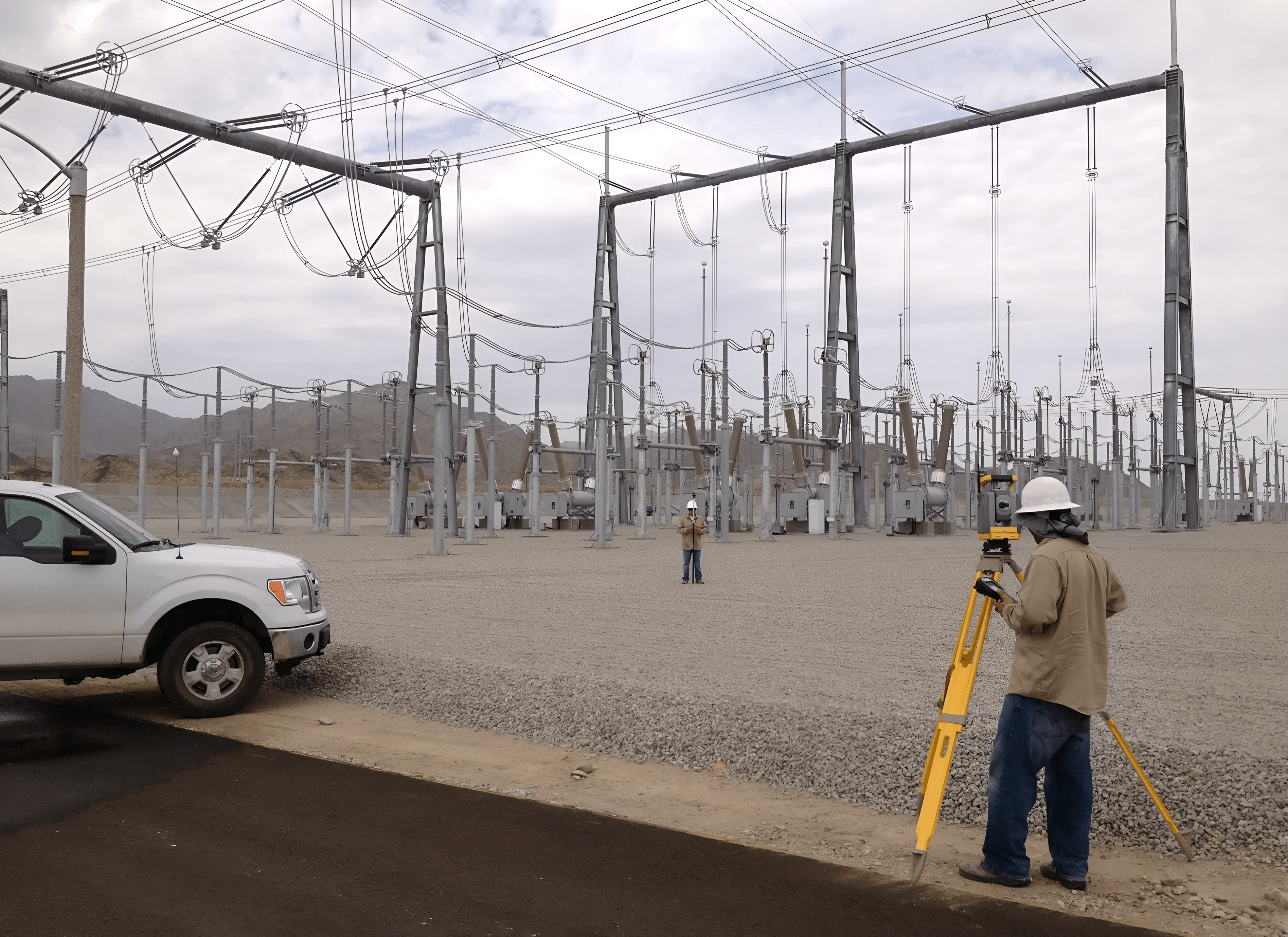
Red Bluff Substation | SCE | Red Bluff, CA
WLG has played an instrumental role in the reinforcement of the region’s electric grid. Working in collaboration with SCE, our survey teams documented boundaries and rights of way for new substations and transmission lines to improve the grid’s resilience, stability and readiness for California’s electrified future.
Mapping
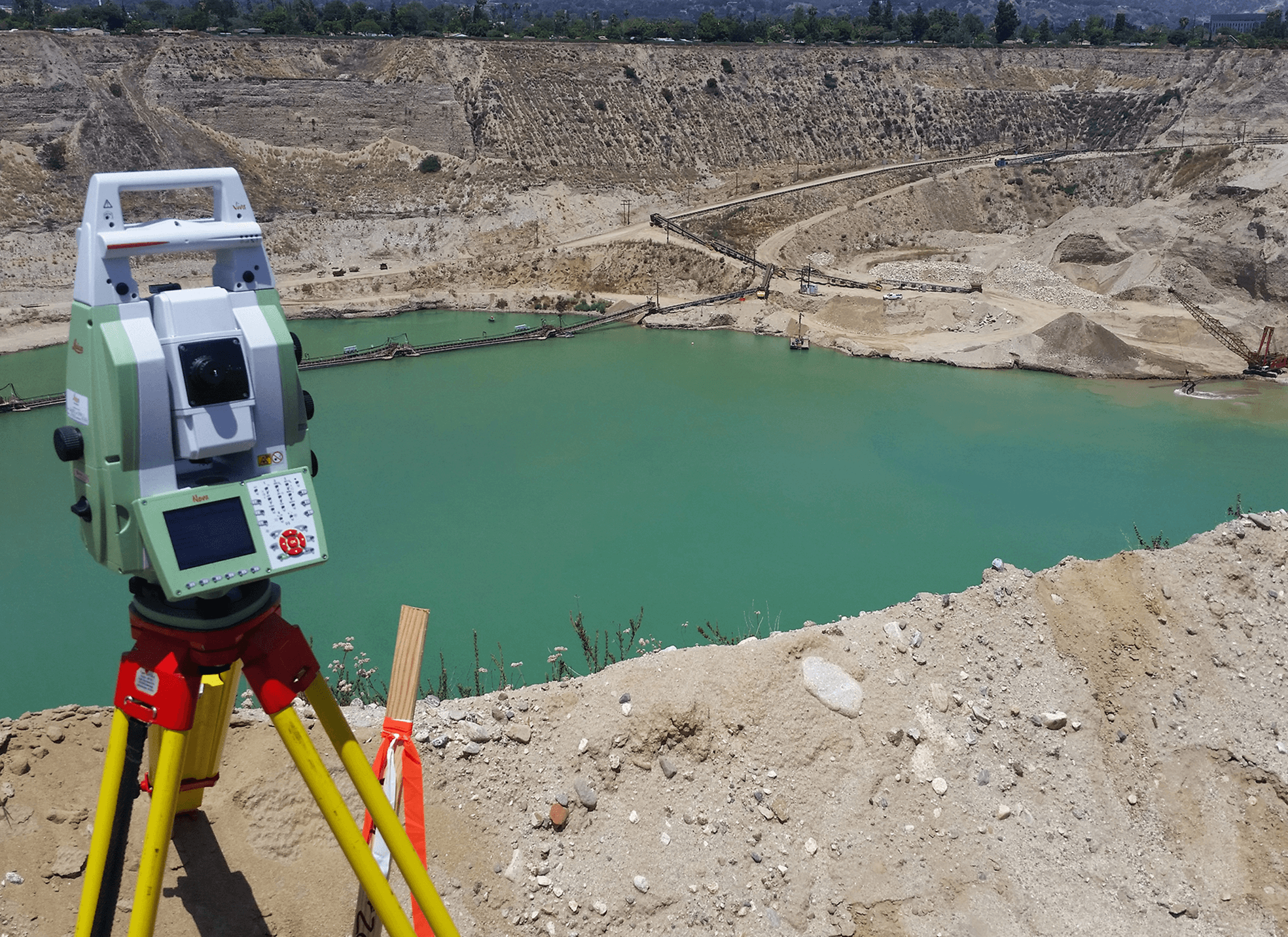
Irwindale Pit Mapping | City of Irwindale | Irwindale, CA
WLG conducts open pit mining surveys to map the City of Irwindale’s extensive rock quarries. Using photogrammetric and bathymetric surveys, conventional and GPS/GNSS techniques, WLG produces accurate lake bottom profiles and color-coded maps used to estimate underwater material extraction, confirm slope stability, and compare material removal volumes year over year. Topographic and boundary survey maps at 11 locations within the city will be used to facilitate pit reclamation for recreational and other uses in the future.
Construction Staking & Support
Public Works
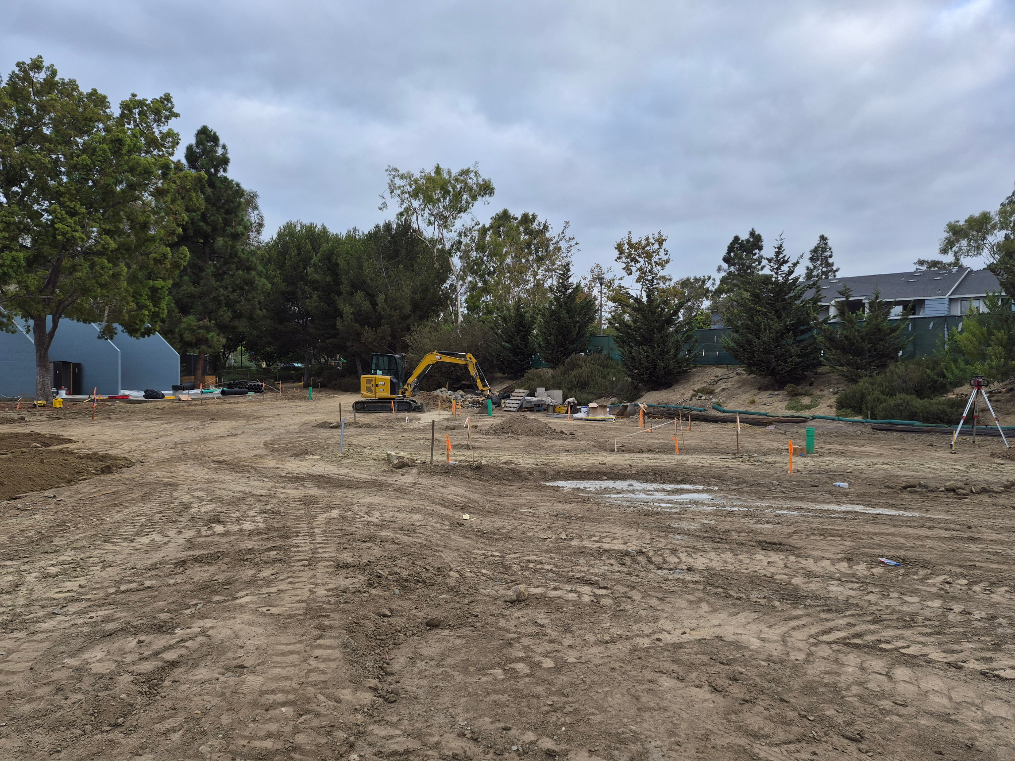
Del Obispo Park Modification | Dana Point, CA
WLG executed construction staking, survey control, and monument preservation services for the Del Obispo Park Modification Project in Dana Point, California. The project included new pickleball courts, reconstruction of the existing basketball court, pedestrian pathway enhancements, site lighting upgrades, parking lot rehabilitation, and drainage improvements. WLG established and maintained project control and furnished staking for grading, paving, drainage facilities, walls, and site improvements to facilitate the accurate construction of recreational amenities and public infrastructure enhancements.
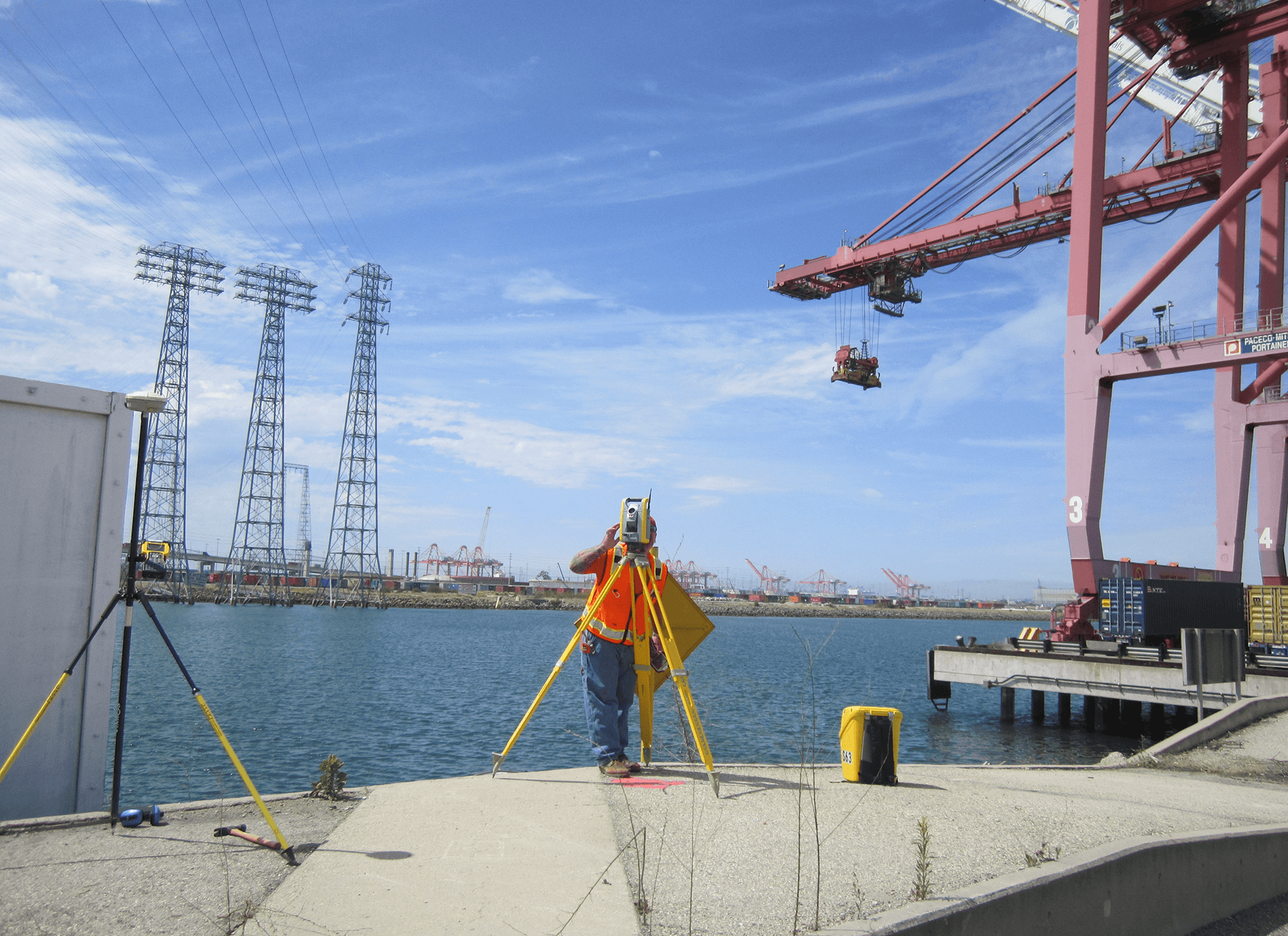
Cerritos Channel Survey | Southern California Edison (SCE), Port of Long Beach (POLB) | Terminal Island, CA
Larger container vessels and increased ship traffic at POLB have required extensive modifications to POLB’s main waterway and electrical infrastructure. Working closely with SCE and POLB Operations, WLG precisely mapped the Cerritos Channel and SCE’s electrical facilities, and provided construction support to insure the smooth flow of cargo through this crucial part of the U.S. supply chain.
Industrial
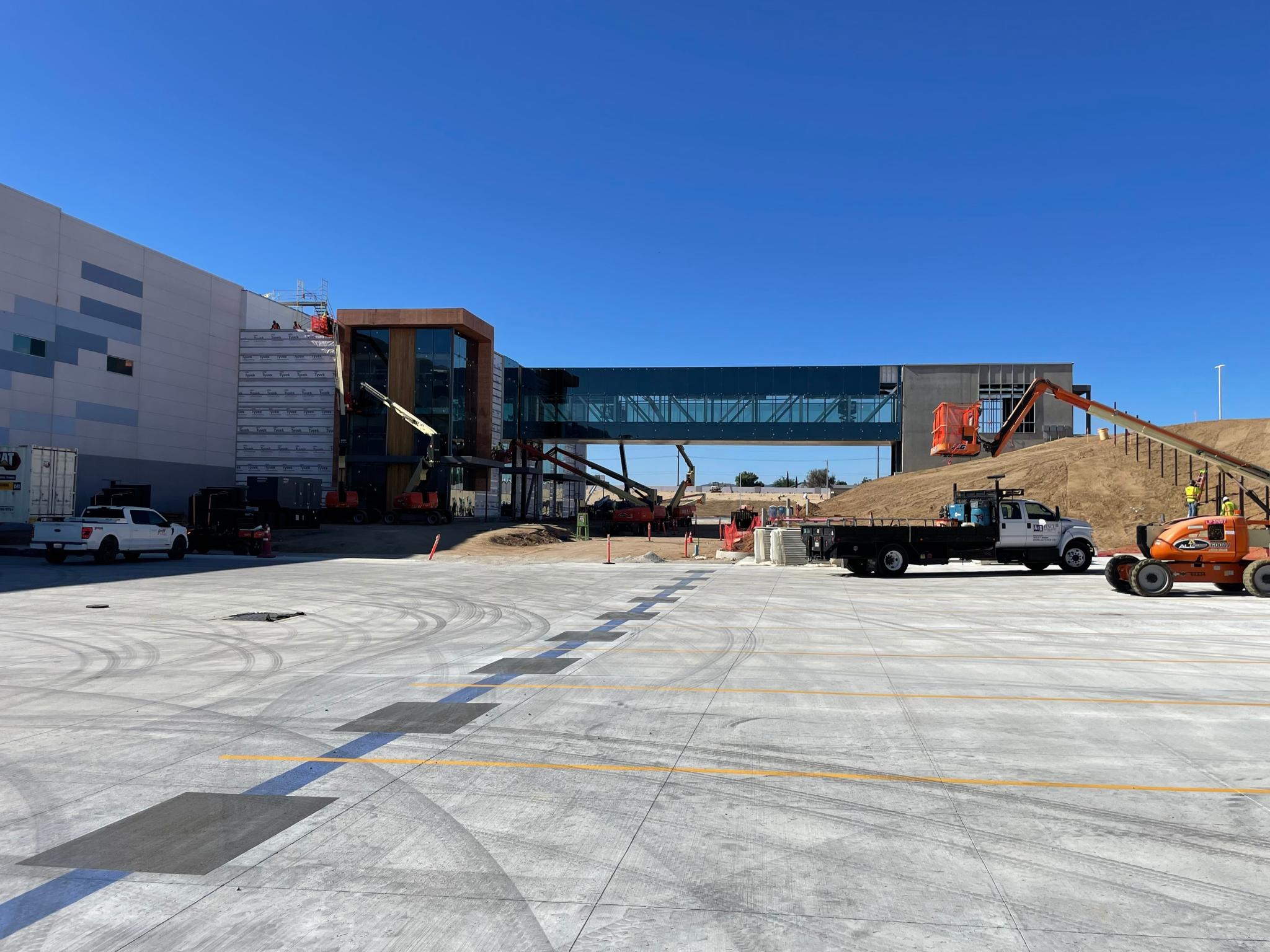
Amazon Warehouse Facility| CLAYCO | Hesperia, CA
WLG executed construction staking, survey control, and field layout services for Project Caliente, a 200-acre industrial development supporting a 2.7-million-square-foot Amazon warehouse facility in Hesperia, California. Services included the establishment of horizontal and vertical control, rough grading staking, building pad layout, utility staking, and construction layout for site infrastructure improvements. During construction, WLG rapidly adapted to a significant redesign of the project’s power infrastructure, staking approximately 10 miles of utility alignment and associated vault locations connecting the facility to a new 33kV power source at a substation nearly 10 miles away. Additional services included staking for storm drain, sanitary sewer, water systems, curb and gutter, detention basins, site lighting, transformer pads, screen walls, and building gridlines, supporting the accurate construction of critical infrastructure and site improvements.
LiDAR and 3D Laser Scanning
WLG’s laser scanning and 360-degree video capabilities guarantee accurate data capture of construction routes and facilities. These datasets, gathered with our arsenal of ground or aerial-based technology, can be used for compliance verification or future retrofit and upgrade studies. Such cutting-edge equipment offers a significant cost saving over deploying crews to physically capture the data.
Terrestrial Laser Scanning
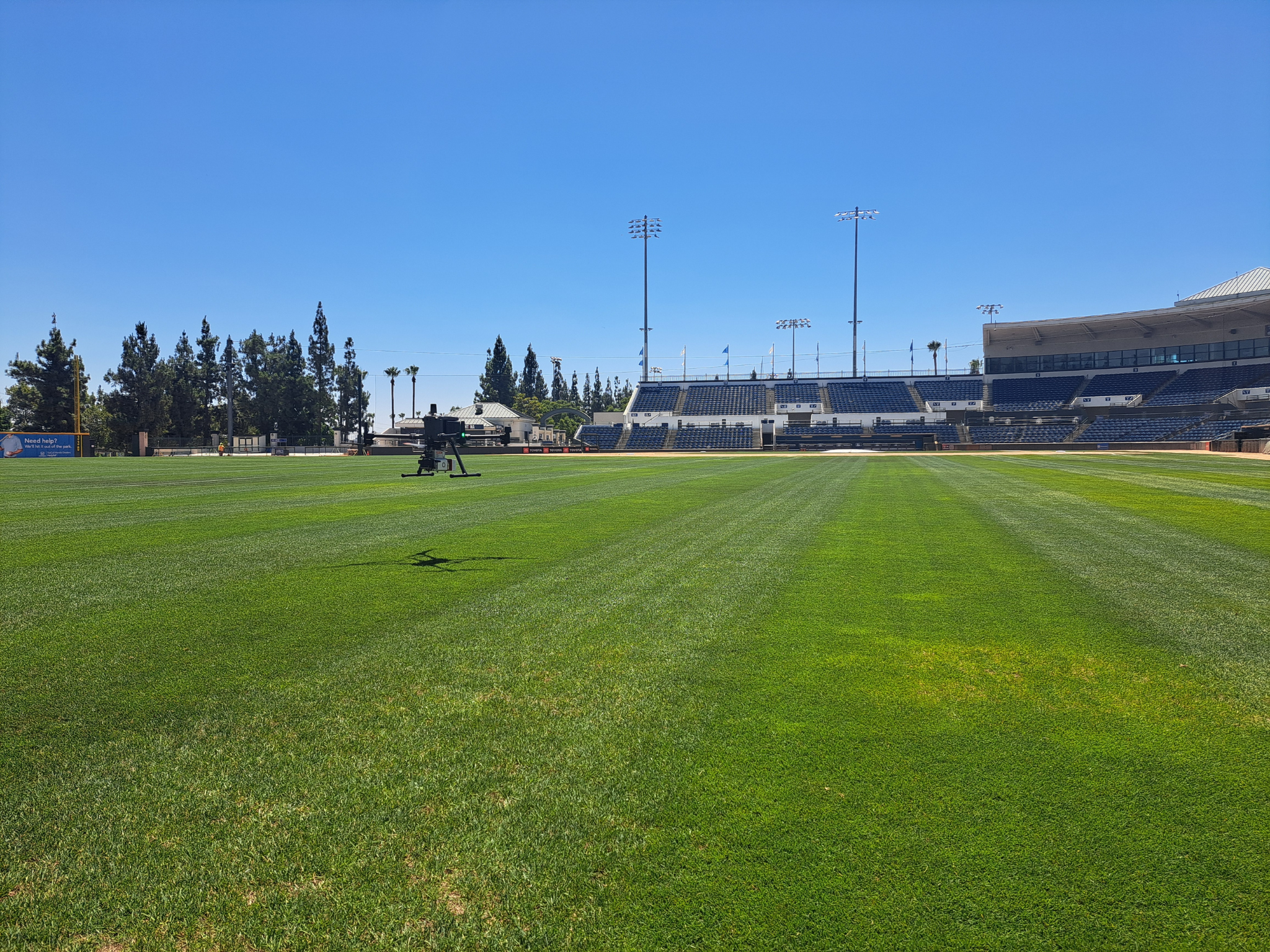
Rancho Cucamonga Quakes | Rancho Cucamonga, CA
WLG conducted terrestrial laser scanning, topographic surveying, utility locating, and utility mapping services for Quakes Stadium in Rancho Cucamonga, California. Utilizing high-resolution laser scanning technology, WLG captured detailed three-dimensional data of the stadium concourse and surrounding facilities to develop accurate existing conditions documentation. Additional services included survey control, topographic mapping, and subsurface utility investigations using electromagnetic locating and Ground Penetrating Radar (GPR). The resulting deliverables supported site planning, engineering design, and infrastructure improvement efforts.
Transportation
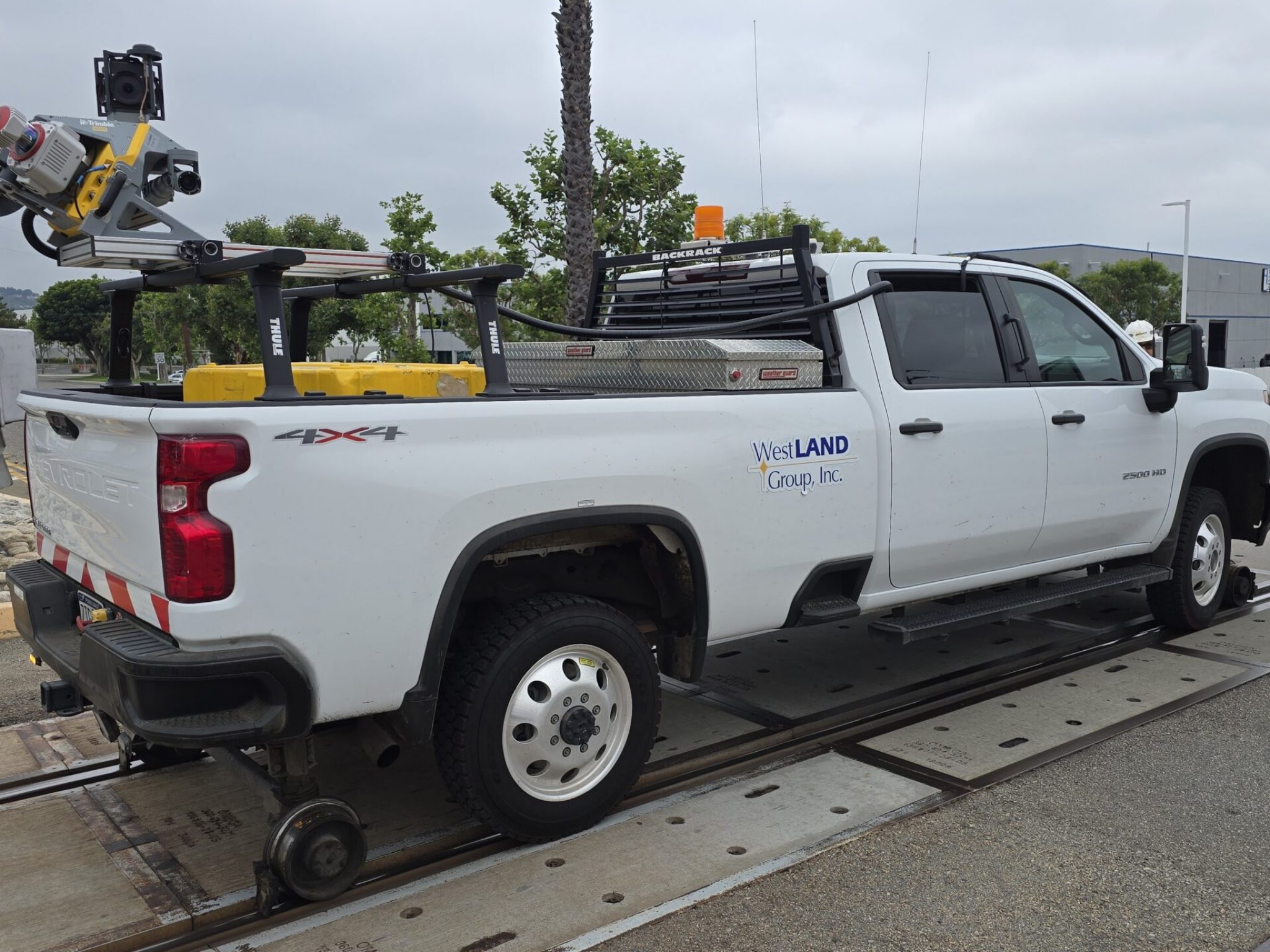
Atwood to Fullerton Station Corridor | BNSF Railway | Orange County, CA
WLG provided comprehensive aerial LiDAR, photogrammetry, and geospatial mapping services for approximately seven miles of the BNSF corridor extending from Atwood to Fullerton Station. The project supported planning and design for future rail infrastructure improvements. Services included UAV-based LiDAR acquisition, aerial imagery collection, ground control establishment, utility mapping integration, and development of detailed topographic base mapping. A key project component involved UAV-based aerial LiDAR and photogrammetric data collection across approximately 600 acres. The resulting geospatial deliverables included high-resolution orthophotography, digital terrain models (DTMs), contours, and engineering-grade mapping to support design and corridor analysis.
Facility
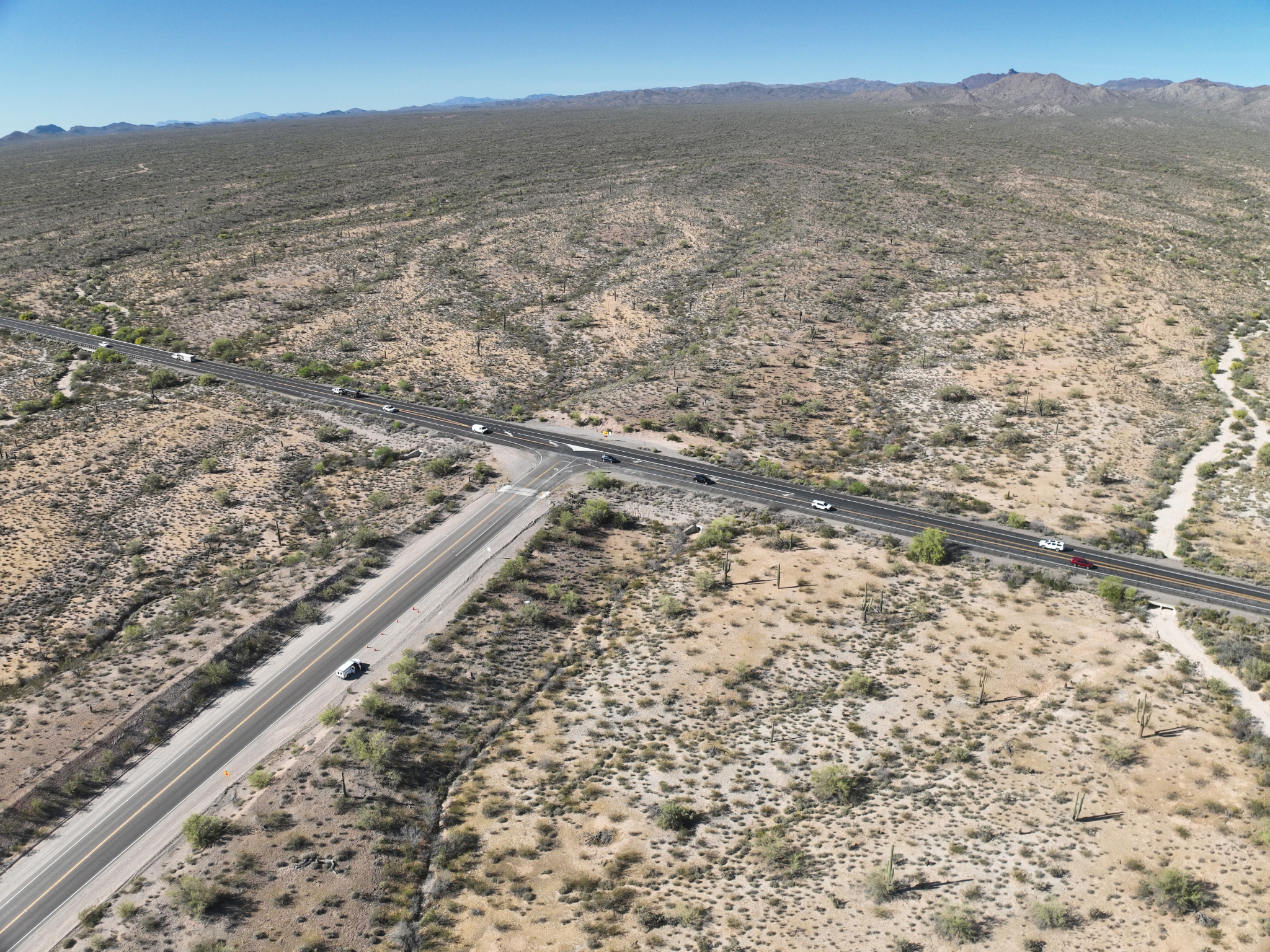
Phoenix Logistics Center and Logistics Park Improvements | BNSF Railway | Phoenix, AZ
WLG performed aerial LiDAR, imagery acquisition, and geospatial mapping services for multiple transportation improvement sites, including the Phoenix LLP At-Grade Crossing and roadway intersections along State Route 74. Leveraging UAV technology and GPS survey control, the team collected high-resolution terrain and surface data across more than 50 acres and multiple corridor locations. Data processing included LiDAR classification, surface modeling, and topographic mapping to produce engineering-ready deliverables supporting transportation planning and design.
Facility
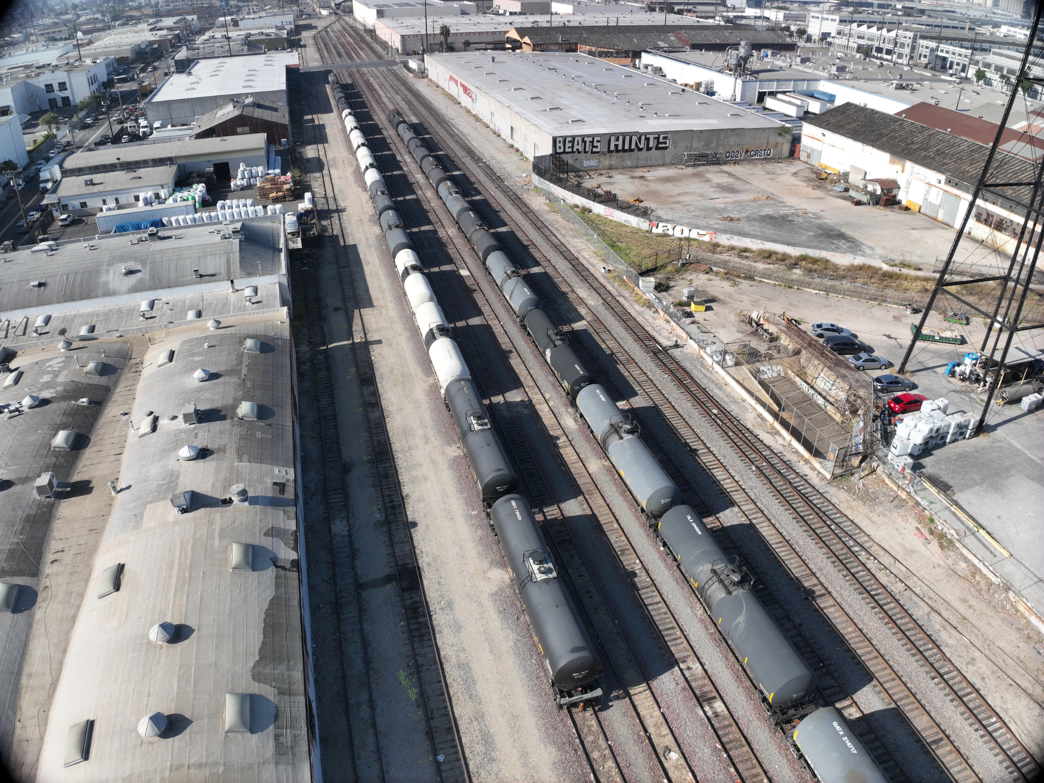
Malabar Yard Rail Facility Mapping | BNSF | Vernon, CA
WLG delivered aerial LiDAR and photogrammetric mapping services to support rail yard improvements within the BNSF Malabar Yard. The project encompassed approximately 2,000 linear feet of active rail corridor and included establishment of a GPS survey control network, detailed ground surveying, utility investigations, and UAV-based aerial LiDAR and imagery acquisition. The collected geospatial data was processed to develop survey-grade topographic mapping, digital terrain models, and engineering base maps depicting existing site conditions and utility infrastructure. Deliverables included georeferenced imagery, terrain models, utility information, and engineering-grade mapping to support rail reconfiguration planning and infrastructure improvements.
Photogrammetry
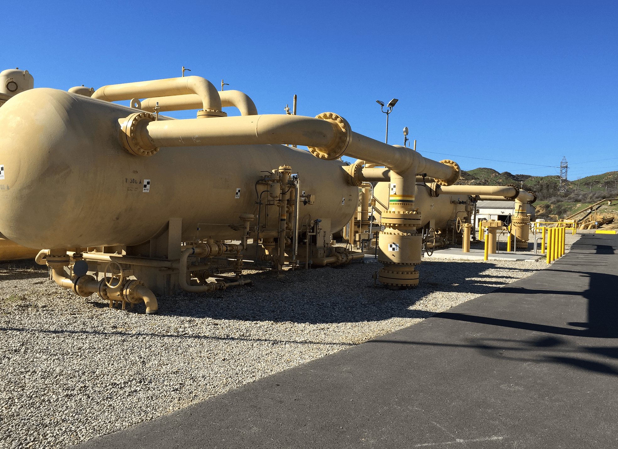
Pipeline Survey | SoCalGas | Los Angeles County, CA
California’s dynamic geography requires gas utilities to maintain precise location information for all wells, pipelines, and fittings. SoCalGas relied on WLG’s photogrammetry and GIS expertise to develop 3D Digital Terrain Maps pinpointing equipment locations. The sophisticated maps are used to study the feasibility of automated hydraulic modeling for new pipeline design, improving safety and gas delivery.
Laser Scanning
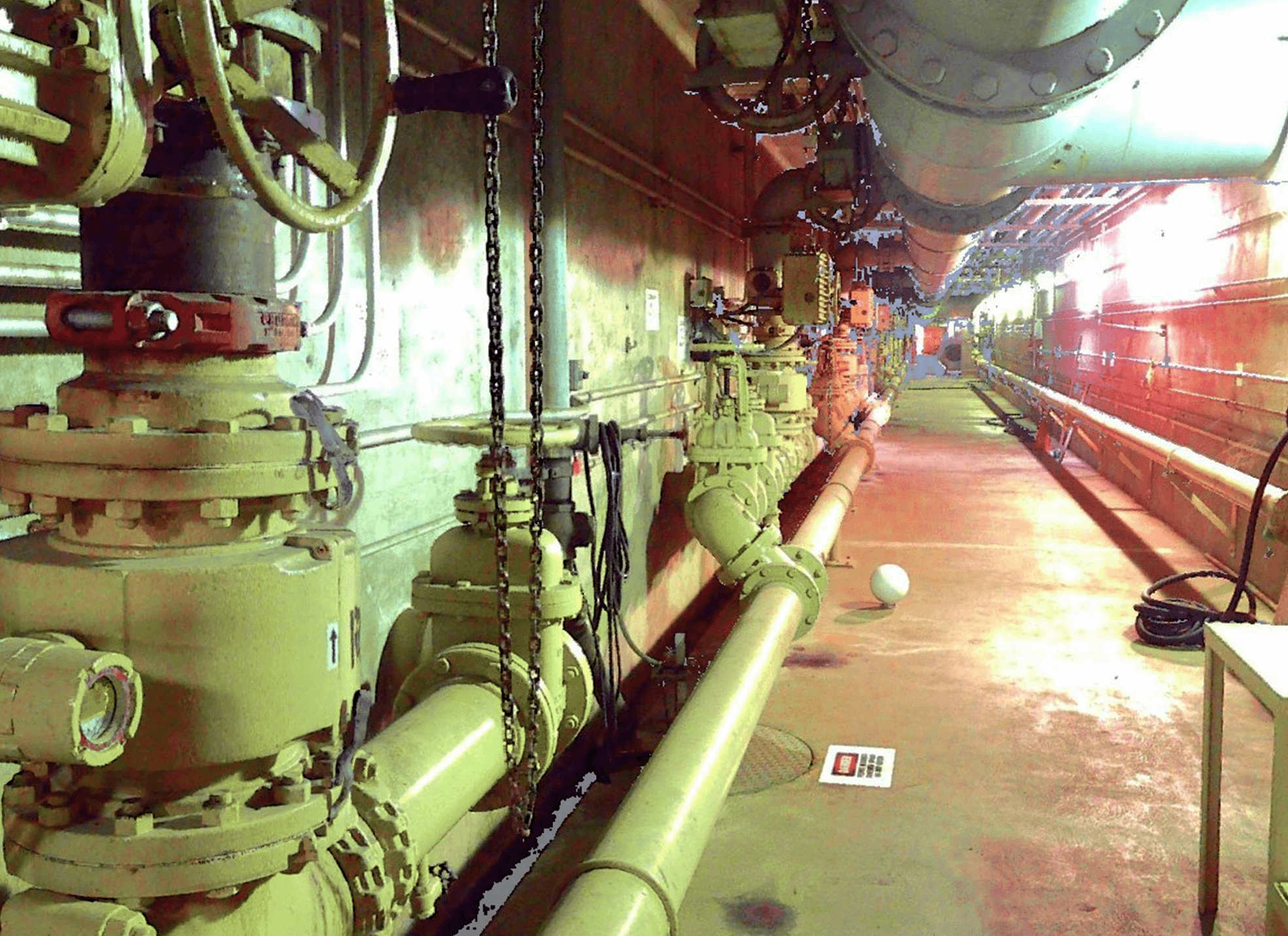
Los Coyotes Water Reclamation Plant | Los Angeles County Sanitation District (LACSD) | Cerritos, CA
LACSD hired WLG to precisely map underground galleries at its Los Coyotes Water Reclamation Plant, so engineers could design electrical conduit routes and conduct conflict analysis. WLG crews provided high-resolution laser scans of approximately 550 feet of tunnels and galleries–all in one day rather than the five to six days a traditional survey would have required. The full survey control report and 3D point cloud of the large data set are easily accessible for convenient, in-office measurements.
Unmanned Aerial Systems (UAS)
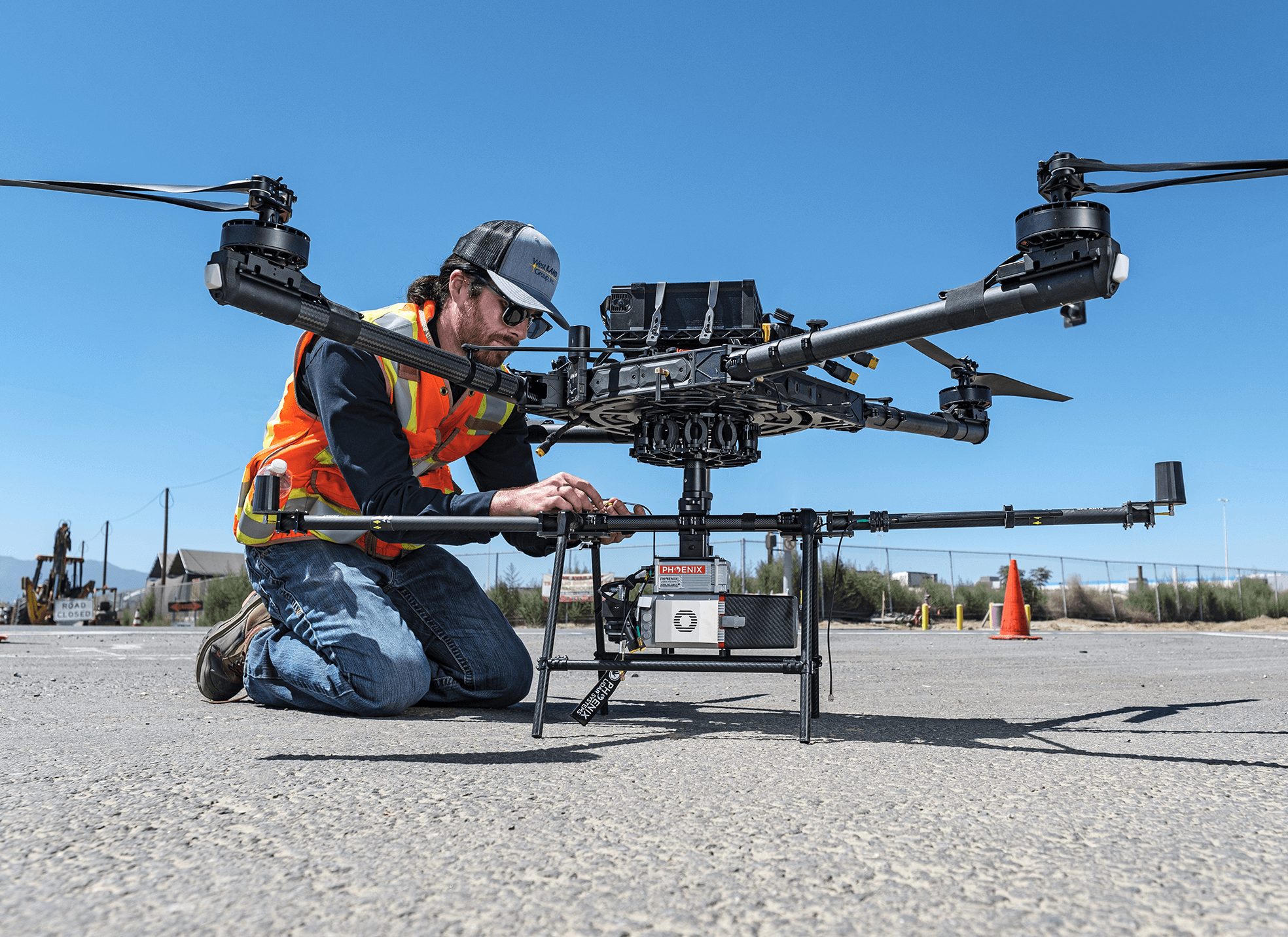
WLG is a pioneer in the use of UAS and UAVs to improve the accuracy, cost-effectiveness and safety of data gathering at large or remote project sites. UAVs provide high-resolution images using GPS coordinates, and can be used to create 3D point clouds and Digital Terrain Models (DTMs). All WLG pilots have the necessary FAA licenses to operate UAVs for geospatial services.
Transmission
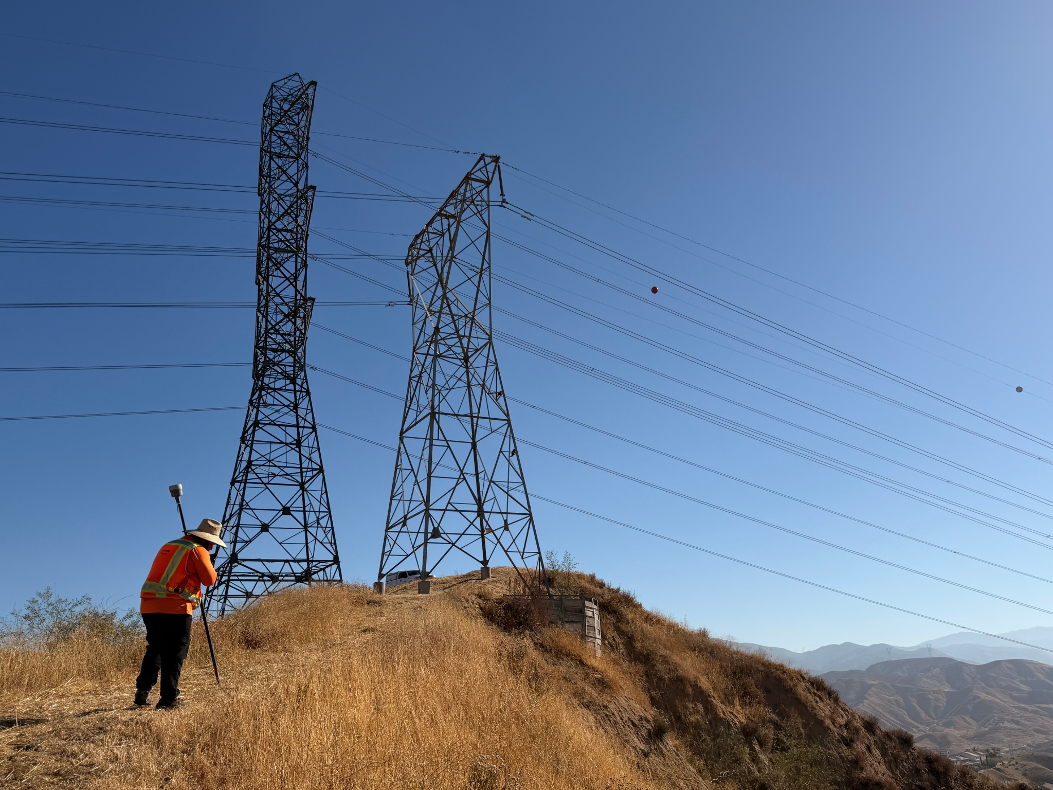
Pardee-Vincent Transmission Line LiDAR Survey | Southern California Edison | Santa Clarita, CA
WLG provided aerial LiDAR, photogrammetry, and topographic mapping services for Southern California Edison’s Pardee-Vincent transmission corridor. Utilizing UAV-based LiDAR technology and aerial imagery, WLG collected high-density geospatial data to develop accurate terrain models, surface representations, and engineering base maps. The project included survey control establishment, supplemental ground surveying, data processing, and quality control to support utility planning, infrastructure improvements, and engineering design.
Transportation
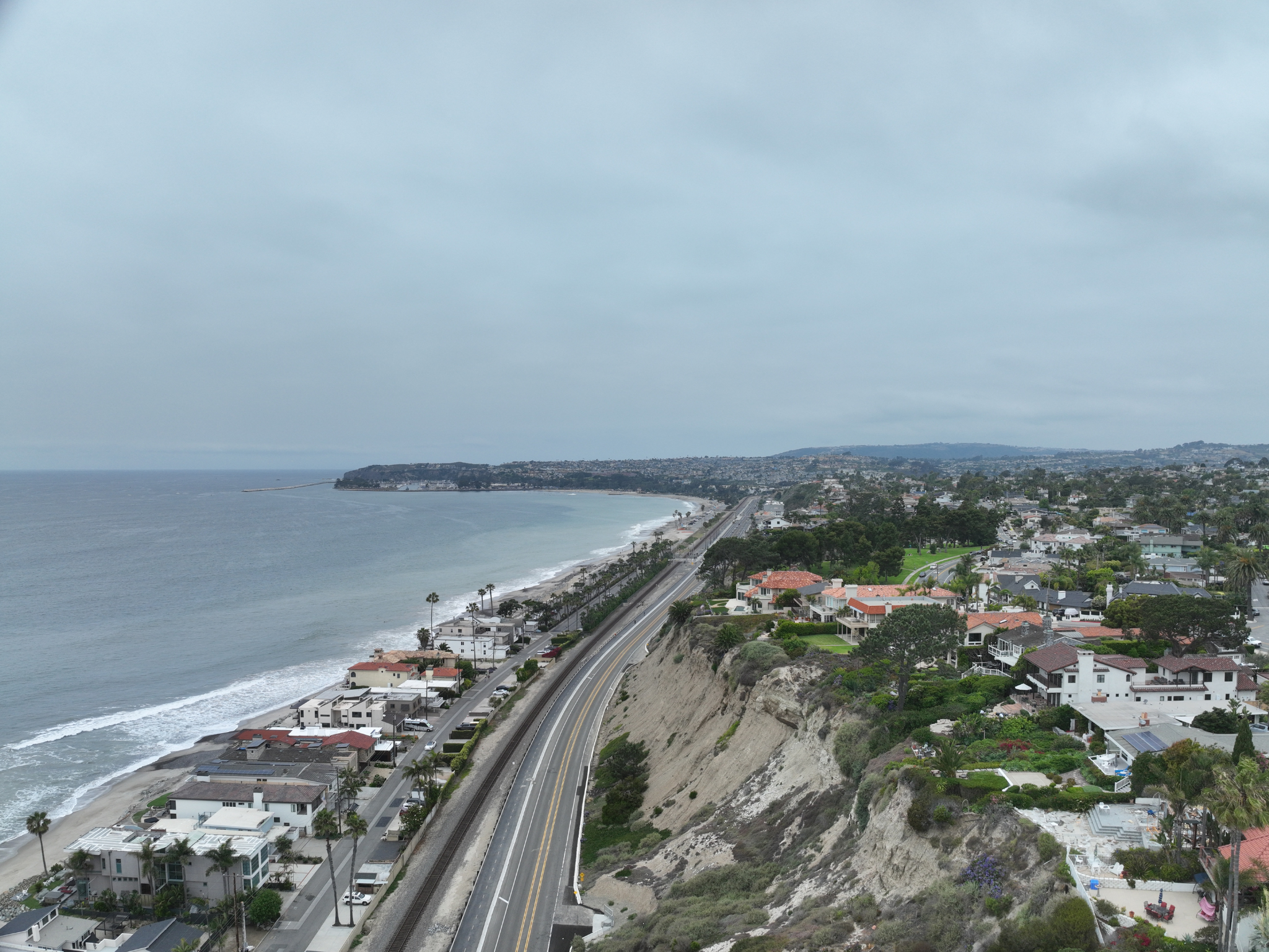
Coast Highway | Dana Point, CA
WLG performed Unmanned Aerial Systems (UAS), aerial LiDAR, and photogrammetric surveying services along the City of Dana Point’s Coast Highway corridor. Utilizing drone-based data acquisition and supplemental conventional surveying, WLG collected high-resolution geospatial data to map roadway infrastructure, drainage facilities, utilities, pavement markings, and other surface improvements. The resulting aerial imagery, LiDAR datasets, and topographic mapping provided accurate existing conditions documentation to support roadway, stormwater, and coastal infrastructure planning and design.
Public Works
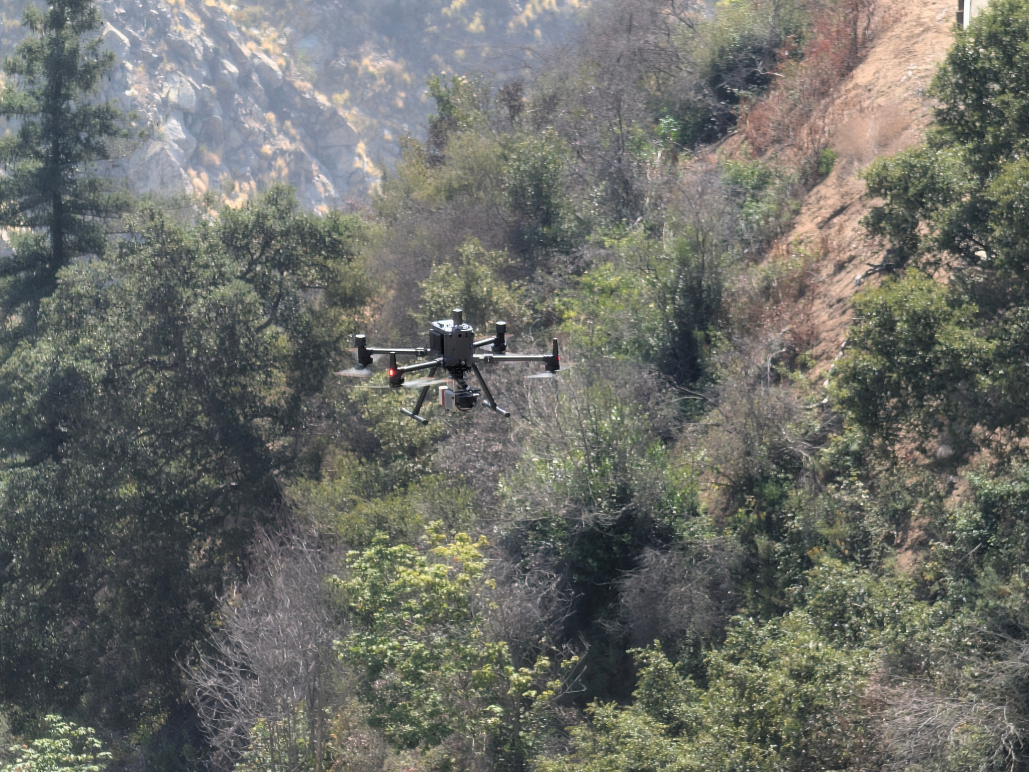
Santa Anita Dam | Los Angeles County Flood Control District | Arcadia, CA
WLG provided aerial LiDAR, photogrammetry, and topographic mapping services for the Santa Anita Dam project to support underground utility investigations, engineering analysis, and project planning. Utilizing UAV-based LiDAR technology and aerial imagery, WLG collected high-resolution geospatial data to accurately document existing site conditions and terrain features throughout the project area. The project included survey control establishment, aerial target deployment, supplemental terrestrial LiDAR and ground surveying, data processing, and quality control.
Public Works
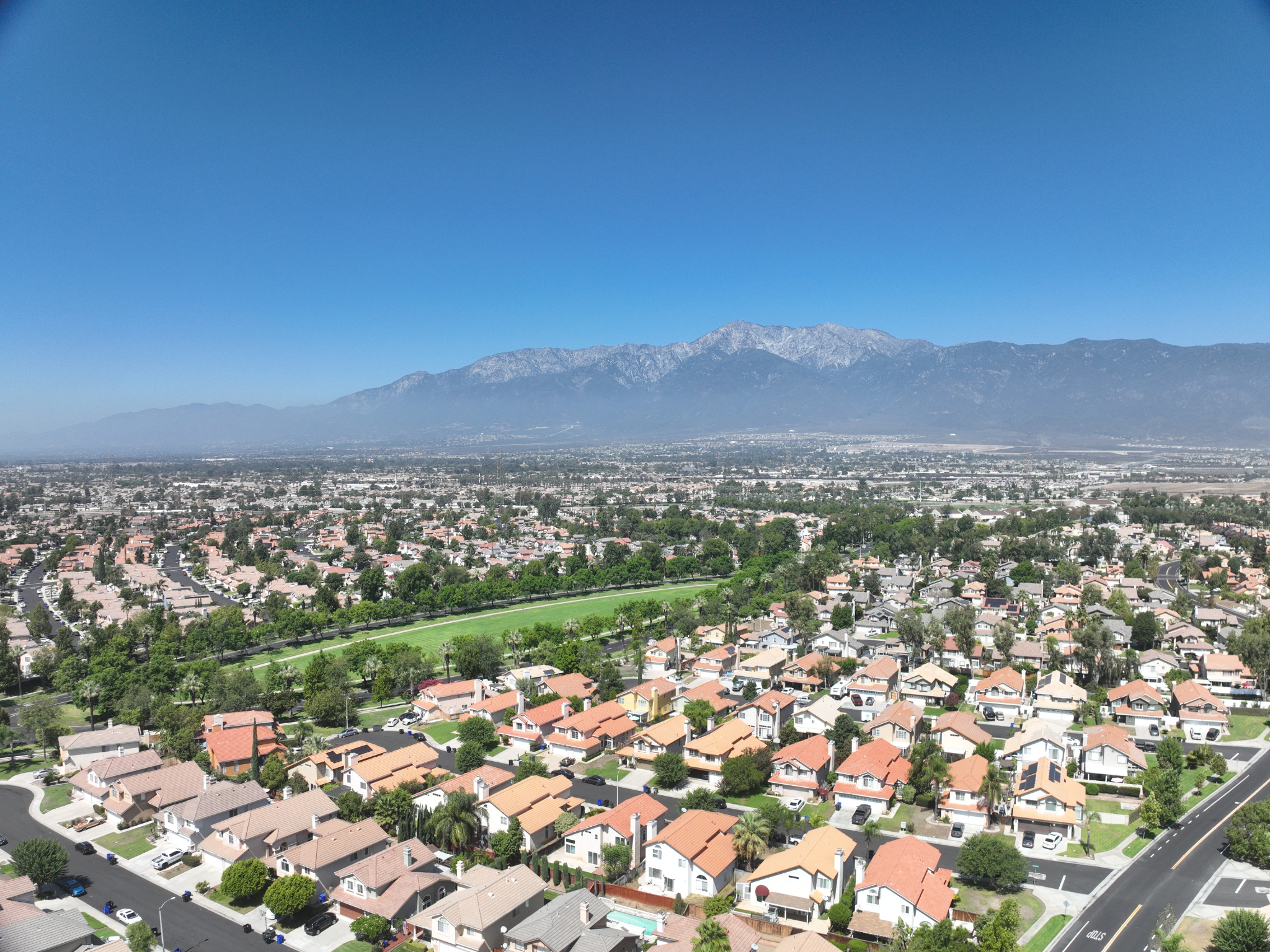
Constitution Way Waterline Improvements | Cucamonga Valley Water District | Rancho Cucamonga, CA
WLG provided UAS aerial surveying, geospatial mapping, and topographic data development services for the Cucamonga Valley Water District’s Constitution Way Waterline project in Rancho Cucamonga, California. Utilizing aerial photogrammetry and survey control established in accordance with National Map Accuracy Standards, WLG developed high-resolution mapping and terrain data covering the project corridor and adjacent improvements. WLG conducted supplemental field surveys to verify utilities, document existing infrastructure, and collect valve elevation data. WLG integrated aerial imagery, survey control, utility research, and topographic information into comprehensive mapping deliverables that supported waterline design, utility coordination, and construction planning.
Transmission
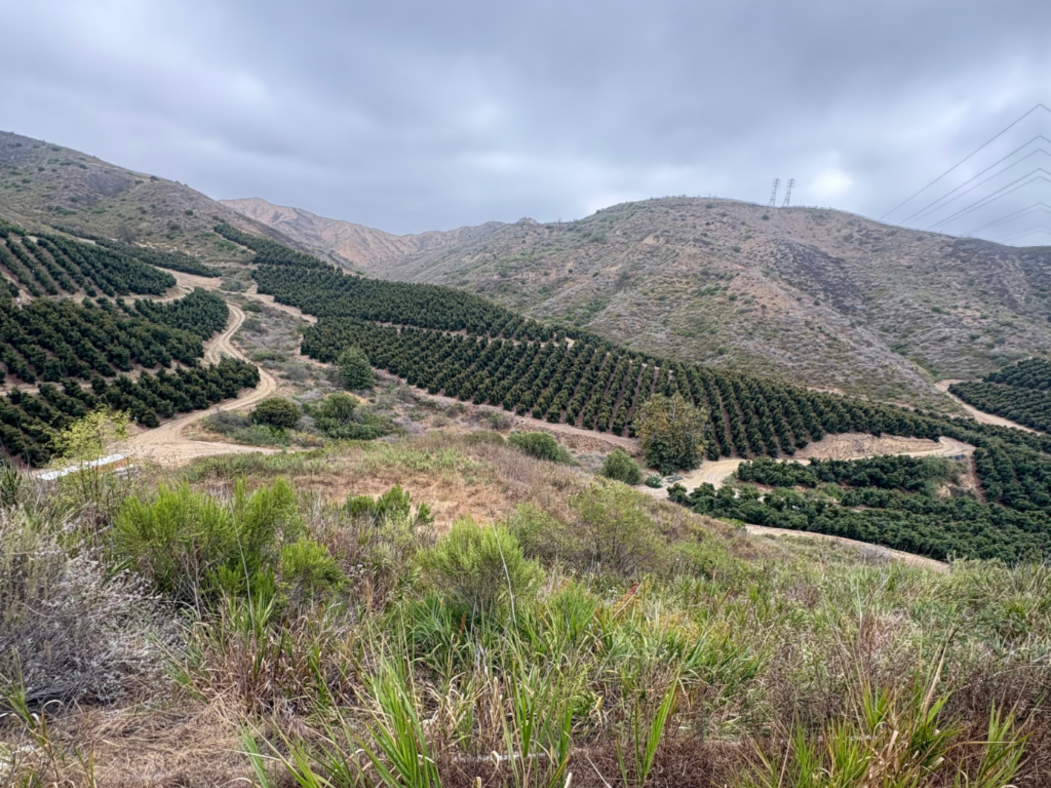
Santa Clara-Camarillo Transmission Corridor | Southern California Edison | Ventura County, CA
WLG provided UAS-supported aerial surveying, geospatial mapping, and topographic data development services for Southern California Edison’s Santa Clara–Camarillo transmission corridor in Ventura County, California. WLG combined high-resolution aerial and field survey data with terrestrial 3D laser scanning to develop a detailed digital terrain model (DTM), one-foot contour mapping, and topographic surfaces based on a 25-foot survey grid. WLG integrated transmission tower infrastructure, access roads, drainage features, and surrounding terrain into AutoCAD Civil 3D deliverables that supported utility corridor planning, engineering design, and infrastructure improvements.
Facility
CUSHENBERRY Facility | Mitsubishi cement corporation | Lucerne Valley, CA
The Mitsubishi Cement Corporation needed to document existing facilities at its Southern California Cushenberry cement plant facility to facilitate new construction. WLG’s UAV team laser-scanned four acres of the facility, including a tower whose 30-foot diameter pipe is used to preheat materials for combustion. WLG provided a point cloud of 30+ scans and 3D modeling of the tower’s structural beams so engineers could design a new catwalk near the tower’s access hatch for kiln sampling and environmental compliance.
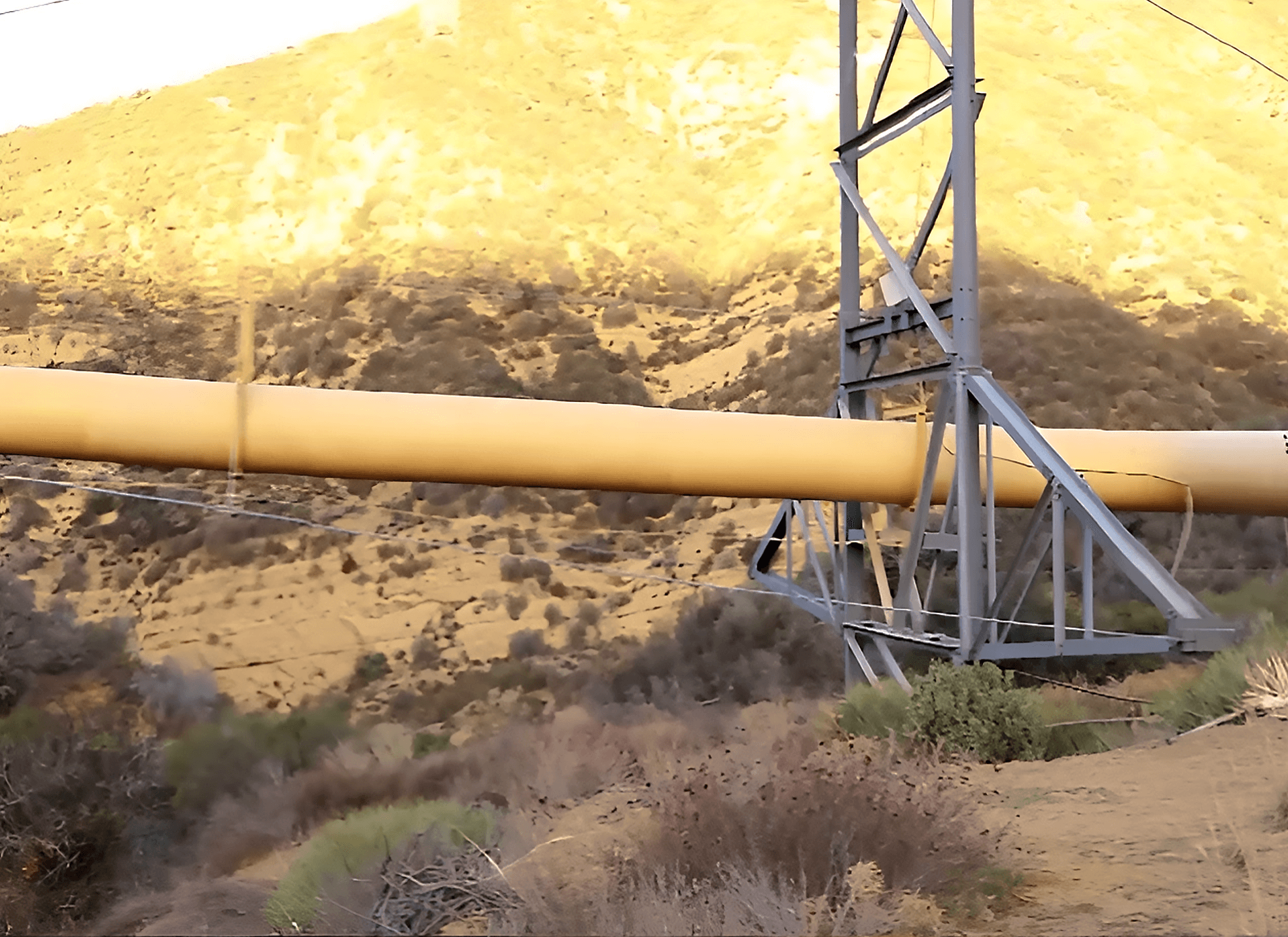
Liebre Span Inspection | SoCalGas | Gorman, CA
WLG’s UAV team has conducted many compliance inspections for major utility companies. Pilots routinely operate these aircraft safely at remote facilities like this high-pressure gas pipeline in earthquake-prone Gorman. UAV inspections are inherently less dangerous to conduct than physical inspections and gather significantly more data than methods relied on in the past.
Meet Our Geospatial Fleet
WLG’s Geospatial Fleet combines advanced aerial, mobile, and ground-based technologies to capture precise data across a wide range of project environments. Equipped with UAVs, LiDAR, and 3D laser scanning technology, WLG’s geospatial professionals collect detailed existing conditions data that supports accurate mapping, modeling, design, and project planning. Featured below is a glimpse of the specialized technology and equipment behind WLG’s comprehensive geospatial services.